FILLMORE PLACE HISTORIC DISTRICT
Designation Report
New York City Landmarks Preservation Commission
May 12, 2009
Cover: 28-10 Fillmore Place (left) and 15-23 Fillmore Place (right).
(Christopher D. Brazee, 2008)
Fillmore Place Historic District
Designation Report
Prepared by Christopher D. Brazee
Edited by Mary Beth Betts, Director of Research
Photographs by Christopher D. Brazee
Map by Jennifer L. Most
Commissioners
Robert B. Tierney, Chair
Pablo Vengoechea, Vice-Chair
Frederick Bland Christopher Moore
Stephen F. Byrns Margery Perlmutter
Diana Chapin Elizabeth Ryan
Joan Gerner Roberta Washionton
Roberta Brandes Gratz
Kate Daly, Executive Director
Mark Silberman, Counsel
Sarah Carroll, Director of Preservation
TABLE OF CONTENTS
FILLMORE PLACE HISTORIC DISTRICT MAP............................................FACING PAGE 1
TESTIMONY AT THE PUBLIC HEARING................................................................................ 1
FILLMORE PLACE HISTORIC DISTRICT BOUNDARIES...................................................... 1
Early History and Development of Williamsburg ...................................................................... 4
Clock & Miller and the Development of Fillmore Place............................................................ 7
Architecture of the Fillmore Place Historic District................................................................. 10
Subsequent History................................................................................................................... 12
FINDINGS AND DESIGNATION.............................................................................................. 15
BUILDING PROFILES................................................................................................................ 17
Driggs Ave, Nos. 662-676 (West Side, Between North 1
st
St and Metropolitan Ave) ............ 17
Driggs Ave, No. 667 (East Side, Between Fillmore Pl and Metropolitan Ave)....................... 24
Driggs Ave, Nos. 673-675 (East Side, Between Grand St and Fillmore Pl) ............................ 26
Fillmore Pl, Nos. 1-23 (North Side, Between Driggs Ave and Roebling St)........................... 29
Fillmore Pl, Nos. 2-32 (South Side, Between Driggs Ave and Roebling St)........................... 40
North 1
st
St, No. 187 (North Side, between Bedford Ave and Driggs Ave)............................. 55
Roebling St, No. 168 (West Side, Between Grand St and Fillmore Pl) ................................... 56

23
32
1
168
187
676
662
667
675
2
Driggs Av
N 1 St
Grand St
Metropolitan Av
Fillmore Pl
Grand St
Roebling St
Fillmore Place Historic District
Brooklyn
Queens
Manhattan
Graphic Source: MapPLUTO, Edition 06C, 2006. May 12, 2009. JM.
100
Feet
Boundary of Historic District
Tax Map Lots in Historic District
Fillmore Place Historic District
Borough of Brooklyn, NY
Landmarks Preservation Commission
Calendared: January 13, 2009
Public Hearing: March 24, 2009
Designated: May 12, 2009
Existing Historic Districts
Fillmore Place Historic District
1
Landmarks Preservation Commission
May 12, 2009, Designation List 414
LP-2333
TESTIMONY AT THE PUBLIC HEARING
On March 24, 2009, the Landmarks Preservation Commission held a public hearing on
the proposed designation of the Fillmore Place Historic District (Public Hearing Item No. 8). The
hearing had been duly advertised in accordance with the provisions of law. Ten witnesses spoke
in favor of designation, including a representative for Councilmember Diana Reyna, four
property owners, and representatives of the Society for the Architecture of the City, the
Municipal Art Society of New York, the New York Landmarks Conservancy, the Williamsburg
Greenpoint Preservation Alliance (formerly known as the Waterfront Preservation Alliance of
Greenpoint and Williamsburg), and the Historic Districts Council. A letter in support of the
designation from the Metropolitan Chapter of the Victorian Society in America was also
presented to the Commission at the hearing. No one spoke in opposition to designation. The
Commission has received several letters—including a number from property owners—and other
statements in support of designation.
FILLMORE PLACE HISTORIC DISTRICT BOUNDARIES
The Fillmore Place Historic District consists of the property bounded by a line beginning
at the intersection of the northern curbline of Fillmore Place and the western curbline of
Roebling Street, continuing southerly across the roadbed of Fillmore Place and along the western
curbline of Roebling Street to a point formed by its intersection with a line extending easterly
from the southern property line of 168 Roebling Street, westerly along said line and the southern
property line of 168 Roebling Street, southerly along a portion of the eastern property line of 30
Fillmore Place, westerly along the southern property lines of 30 through 18 Fillmore Place,
southerly along a portion of the eastern property line of 16 Fillmore Place, westerly along the
southern property lines of 16 through 10 Fillmore Place, northerly along a portion of the western
property line of 10 Fillmore Place, westerly along the southern property line of 675 Driggs
Avenue to the eastern curbline of Driggs Avenue, northerly along said curbline to a point formed
by its intersection with a line extending easterly from the northern curbline of North 1
st
Street,
westerly across the roadbed of Driggs Avenue and along the northern curbline of North 1
st
Street
to a point formed by its intersection with a line extending southerly from the western property
line of 676 Driggs Avenue, northerly along the western property lines of 676 through 662 Driggs
Avenue, easterly along the northern property line of 662 Driggs Avenue to the western curbline
of Driggs Avenue, southerly along said curbline to a point formed by its intersection with a line
extending westerly from the northern property line of 667 Driggs Avenue, easterly along said
line across the roadbed of Driggs Avenue and along the northern property lines of 667 Driggs
Avenue and 7 Fillmore Place, northerly along a portion of the western property line of 9 Fillmore
Place, easterly along the northern property lines of 9 through 21 Fillmore Place, southerly along
a portion of the eastern property line of 21 Fillmore Place, easterly along the northern property
line of 23 Fillmore Place, southerly along the eastern property line of 23 Fillmore Place to the
northern curbline of Fillmore Place, easterly along said curbline to the point of the beginning.
2
SUMMARY
The Fillmore Place Historic District—located in the Williamsburg neighborhood of
Brooklyn—is a small and intact enclave of 29 properties, mostly multi-family flats buildings
erected in the mid-nineteenth century during a period of rapid urbanization in the area.
Williamsburg had remained rural farmland into the early nineteenth century. Real estate
speculators, lead by Richard Woodhull and Thomas Morrell, began in 1802 to acquire large
tracts of land that they divided up into urban building lots. While their efforts were largely
unsuccessful, a second generation of developers did succeed in attracting new residents and the
population of the area began to grow rapidly by the late 1820s. The Village of Williamsburgh
was chartered in 1827; its boundaries were greatly expanded in 1835; and in 1840 it became the
Town of Williamsburgh, politically independent from Bushwick. The area’s population
continued to increase at an astounding pace, doubling between 1840-45 and at an even faster rate
in the late 1840s and 1850s as a large number of German immigrants began to settle in the area.
Williamsburgh officially became a city in 1852—just 25 years after it had been recognized as a
village—and was the twentieth largest urban area in the country. It soon consolidated with
Brooklyn in 1855, at which time it lost the “h” at the end of its name, becoming the
neighborhood of Williamsburg.
It was during this period of rapid urban growth that Ephraim Miller and Alfred Clock
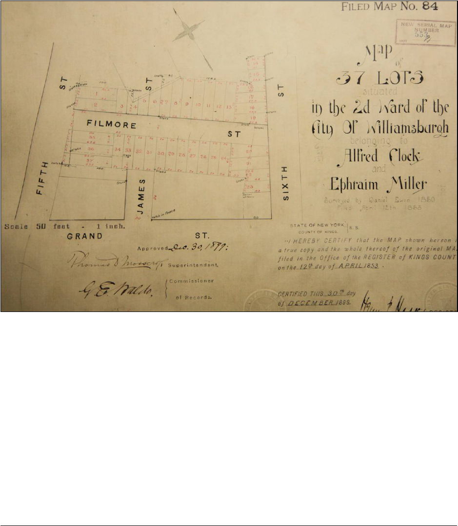
began to invest in real estate in Williamsburg. In the late 1840s and early 1850s they acquired
several contiguous parcels of land on a large block in the center of town and hired a surveyor to
map out 37 individual building lots facing onto a new street they created in the middle of the
property. Fillmore Place, as the street came to be named, was soon built up with a number of
three-story multi-family flats buildings. Those on the north side of the street were likely erected
for individual property owners, perhaps with Clock and Miller’s assistance. The south side of
Fillmore Place, however, was developed as a contiguous row by the pair. They commissioned
masons Jacob Sheppard and John Rourke to construct the nine houses now known as 12 to 28
Fillmore Place. Clock and Miller also sold a number of lots facing onto the busier thoroughfares
of Roebling Street and Driggs Avenue. These parcels were developed with structures similar in
many ways to those on Fillmore Place but incorporating ground floor storefronts. A few of the
lots on Fillmore Place that had not been improved during the 1850s were developed in
subsequent decades. 10 and 30 Fillmore Place were constructed in the early 1870s and serve as
effective bookends to the earlier row of nine houses, while 11 Fillmore Place was erected in
1881 for owner Samuel W. Woolsey. The Fillmore Place Historic District also includes several
properties—notably the short row at 672 to 676 Driggs Avenue and the individual structure at
no. 662—that were not part of Clock and Miller’s plan of 37 lots but that were built at about the
same time and are similar architecturally to the structures on Fillmore Place.
Most of the buildings within the Fillmore Place Historic District were designed in a
restrained Italianate style. The austere planar brick façades are ornamented primarily by
projecting stone door hoods, molded stone lintels and projecting sills, and bracketed wood
cornices. Several retain their original iron areaway fences and stoop railings. While the buildings
were erected as multi-family dwellings for working class tenants, their architecture has more in
common with fashionable middle- and upper-class single-family row houses than substandard
tenements. The exterior design of the structures on Fillmore Place is in fact quite similar to that
of buildings erected in elegant neighborhoods such as Chelsea in Manhattan.
3
The buildings within the Fillmore Place Historic District have a history of long-term
ownership and occupancy. It was not unusual for families to retain possession of their buildings
for several decades, and many of the houses were owner-occupied. This stability in ownership
and occupancy patterns on Fillmore Place meant that the street saw few significant changes in
later decades, even as the neighborhood around it was undergoing major transformations. Even
the opening of the Williamsburg Bridge in 1903, which brought a huge influx of new residents to
the area, had little impact on the physical fabric of the street and it remains perhaps the most
intact enclave of buildings erected during Williamsburg’s initial period of urban development.
The most famous resident to have lived within the Fillmore Place Historic District—author
Henry Miller—moved into the house at 662 Driggs Avenue in 1891, just before the opening of
the Williamsburg Bridge. His description of Fillmore Place in his novel The Tropic of Capricorn
continues to reflect many people’s sentiment of the little block: “[it was] the most enchanting
street I have ever seen in all my life. It was the ideal street—for a boy, a lover, a maniac, a
drunkard, a crook, a lecher, a thug, an astronomer, a musician, a poet, a tailor, a shoemaker, a
politician.”

4
THE HISTORICAL AND ARCHITECTURAL DEVELOPMENT OF THE FILLMORE
PLACE HISTORIC DISTRICT
Early History and Development of Williamsburg
1
The first inhabitants of western Long Island were the Canarsee, the indigenous people of
Brooklyn who were members of the Algonquin linguistic group that occupied the Atlantic
seaboard from Canada to North Carolina.
2
The Canarsees were an autonomous band of Delaware
(Leni Lenape) Native Americans. They lived communally in several settlements in west
Brooklyn, hunting and fishing in the low-lying marshes of Wallabout Bay (now the site of the
Brooklyn Navy Yard). Europeans—at first primarily fur traders from England, the Netherlands,
and Sweden—arrived in the early seventeenth century and began conducting business with the
region’s indigenous population. By the 1630s, Dutch settlers began taking control of the western
end of Long Island from the Canarsee.
3
In 1638, West India Company Director-General Willem
Kieft “purchased” the large tract of land between Wallabout Bay and Newtown Creek for the
sum of “eight fathoms of duffels, eight fathoms of wampum, twelve kettles, eight adzes…and
eight axes, with some knives, beads, [and] awl-blades.”
4
Troubled relations between Dutch
colonists and Native Americans, however, prevented organized settlement of the area for several
decades.
5
Even after the village of Boswijck (later anglicized to Bushwick) was established in
1660, the land that now comprises the neighborhood of Williamsburg remained sparsely
1
Portions of this section are adapted from: Landmarks Preservation Commission (LPC), Brooklyn Public Library,
Williamsburgh Branch Designation Report (LP-1995) (New York: City of New York, 1999), prepared by Virginia
Kurshan. Information in this section is based on the following sources: Ancestry.com, 1790 United States Federal
Census [database online] (Provo, UT: Generations Network, 2000); Ancestry.com, 1800 United States Federal
Census [database online] (Provo, UT: Generations Network, 2004); Eugene L. Armbruster, The Eastern District of
Brooklyn (New York, 1912); Armbruster, Brooklyn’s Eastern District (Brooklyn, NY, 1942); Reginald Pelham
Bolton, New York City in Indian Possession, 2d ed. (New York: Museum of the American Indian, Heye Foundation,
1920; reprint 1975); Edwin F. Burrows and Mike Wallace, Gotham: A History of New York City to 1898 (New
York: Oxford University Press, 1999); Harry W. Havermeyer, Merchants of Williamsburgh, Frederick C.
Hevemeyer, Jr., William Dick, John Mollenhauer, Henry O. Havemeyer (New York, 1989); LPC, Vinegar Hill
Historic District Designation Report (LP-1952) (New York: City of New York, 1997), prepared by Donald Presa;
LPC, Williamsburgh Savings Bank Interior Designation Report (LP-1910) (New York: City of New York, 1996),
prepared by Gale Harris; Nathaniel S. Prime, A History of Long Island From its First Settlement by Europeans to the
Year 1845 (New York: Robert Carter, 1845); Samuel Reynolds, A History of Williamsburgh (Williamsburgh, NY:
Joseph C. Gandor, 1852); Henry R. Stiles, ed. History of the County of Kings and the City of Brooklyn (New York:
W.W. Munsell & Co., 1884).
2
This section on the Native American occupants of Brooklyn was adapted from LPC, Vinegar Hill Historic District
Designation Report.
3
The Dutch West India Company’s Charter of Freedoms and Exemptions of 1629 (also known as the Charter of
Liberties) gave official sanction to the colonization of New Netherland; previously the Company had limited
wholesale settlement of the area in favor of maintaining a few minimally populated trading posts. The first three
large tracts of land on Long Island were acquired between 1636 and 1638 by William Adriaense Bennett and
Jacques Bentyn in the Gowanus area, Joris Jansen Rapalje around Wallabout Bay, and Wouter van Twiller, Jacob
van Corlear, Andries Hudde, and Wolphert Gerritsen near Jamaica Bay. Burrow and Wallace, 2829.
4
The full deed is transcribed in Armbruster (1912), 129-30. The Native American “system of land tenure was that of
occupancy for the needs of a group” and those sales that the Europeans deemed outright transfers of property were
to the Native Americans closer to leases or joint tenancy contracts where they still had rights to the property. Bolton,
7.
5
A number of individuals had established homesteads on western Long Island even before Kieft’s purchase, but
they were widely spaced across the region and had no official government of any sort (see Ambruster [1912], 18-19
for a list of these early residents).

5
inhabited by only a handful of individual farmsteads throughout the seventeenth and eighteenth
centuries.
6
One of these homesteads was what came to be known as the Meserole or Keikout Farm.
Initially patented by the West India Company to Reyer Lambertsen in 1646, the plot
encompassed the land now roughly bounded by South Sixth Street and North First Street from
the East River to Roebling Street—including most of property within the boundaries of the
Fillmore Place Historic District.
7
The parcel was eventually acquired by Jean Mesurolle (Jan
Meserole), a French immigrant who arrived in New York in 1663. Meserole’s decedents
continued to occupy the farm through the first half of the seventeenth century. Following the
death of Jan Meserole III in 1756, portions of the farm were partitioned and sold off. Twelve
acres near the foot of Grand Street were purchased by Francis Titus, who accumulated
substantial land holdings in area during his life.
8
Much of this property was later conveyed to his
son, Charles Titus, who continued to maintain a farm there into the early nineteenth century.
Census records from the period indicate that many of the families living in what is now
Williamsburg—including both the Meserole and Titus households—owned slaves.
9
At the turn of the century, business people from around the metropolitan region began to
take notice of the Williamsburg area.
10
The location offered a number of enticements for real
estate developers—most notably its proximity to Manhattan, whose urban boundary had by this
point extended northwards and now lay directly across the East River from the old Meserole
Farm. One of the first speculators was Richard M. Woodhull, a prosperous Manhattan merchant
who purchased a thirteen-acre tract at the foot of present-day North 2
nd
Street (Metropolitan
Avenue) from Charles Titus in 1802.
11
After having it surveyed by his friend Colonel Jonathan
Williams, Woodhull named the area Williamsburgh in his honor and began to sell lots there. He
also started a ferry service to Rivington Street in New York from the foot of North 2
nd
Street,
which he called the Williamsburgh Ferry. A rival development was soon established just to the
south by Thomas Morrell, who acquired 23 acres at the foot of Grand Street from Folkert Titus
(Charles Titus’s son). Morrell and his partner James Hazard mapped out their own set of city lots
and named the settlement Yorktown. They also opened a ferry running from Grand Street in
Yorktown to Grand Street, Manhattan. Neither development, however, met with much initial
success. Woodhull’s operation failed around 1812; his real estate venture was taken over by his
father-in-law James H. Maxwell, while his ferry was subsumed by his rival Morrell. Maxwell
was later able to sell off some of the Williamsburgh settlement, but mostly to other speculators
rather than individual property owners. James Conklin, for example, purchased a substantial
number of parcels in 1815, including much of land within the boundaries of the Fillmore Place
Historic District. The slow market for urban building lots in the area eventually caused Maxwell
to fail as well and his stake in the remainder of the Williamsburgh development was sold at a
6
Boswijck—chartered and named by Director-General Peter Stuyvesant—originally consisted of 22 house lots
surrounded by a protective palisade stockade.
7
Stiles, 308.
8
Stiles, 314.
9
1790 United States Federal Census, New York State, Kings County, Bushwick, 18; 1800 United States Federal
Census, New York State, Kings County, Bushwick, 19.
10
The area was at this time known as the Bushwick Shore or the Strand.
11
Not wanting to alert the local residents of his real estate aspirations, Woodhull apparently employed Samuel Titus
as an intermediary in the purchase of the land. Stiles, 379. Woodhull later acquired an additional five acres from
Francis Titus in 1805.

6
Sheriff’s auction in 1818.
12
The name Williamsburgh, however, remained in popular use and
eventually came to denote the entire area between Wallabout Bay and the Bushwick Creek.
The urban development of Williamsburgh, while initially slow, proved to be inexorable.
General Jeremiah Johnson helped the process along when he opened the first public road from
Brooklyn to Bushwick through Williamsburgh.
13
A second generation of speculators benefitted
from the renewed interest in the area and additional farmsteads were acquired and mapped into
city lots by people such as Noah Waturbury (often called the “Father of Williamsburgh”), David
Dunham, and Garret and Grover C. Furman
14
By 1827 development of the area had progressed
sufficiently that local residents successfully petitioned the state legislature for village status. The
Village of Williamsburgh was then incorporated on April 14, 1827 with a population of 1,007.
The original limits encompassed the area now bound roughly by Division Avenue on the south,
Keap Street and Union Avenue on the west, and Bushwick Creek (approximately North 13
th
Street) on the north. Growth was steady in the following years and in 1835 the village again
petitioned the state legislature, this time to extend the boundaries of the village eastward to
Bushwick Avenue.
The Panic of 1837 slowed Williamsburgh’s growth, but only briefly. In 1840 the village
was set off from Bushwick as its own township. At this time it could claim six churches, several
schools, two shipyards, and numerous factories. It supported by a population of 5,094 people and
several ferry lines ran between this part of Kings County and Manhattan, providing convenient
connections for workers and commercial opportunities for small businesses—and helping the
industries that by the 1850s were being established along the East River waterfront.
15
The
population of Williamsburgh more than doubled between 1840 and 1845, and grew at an even
greater rate during the late 1840s and early 1850s when an influx of German immigrants arrived
in the area. When Williamsburgh became a city on January 1, 1852, its population was 35,000
and it was the twentieth largest urban area in America. It remained an independent municipality
for only a few years, however, before consolidating with the City of Brooklyn on January 1,
1855. After this, the area lost the “h” at the end of its name and it—along with the adjacent
Bushwick and Greenpoint neighborhoods—came to be known as Brooklyn’s Eastern District.
12
David Dunham, Moses Judah, and Samuel Osborn acquired the property following a judgment in favor of James
J. Roosevelt.
13
Stiles notes that Johnson’s efforts to open the road “contributed more, perhaps, than any other similar
improvement, to the ultimate growth and prosperity” of Williamsburgh. Stiles, 382.
14
The Furmans acquired 25 acres of land in Williamsburgh in 1825. Even at this date they were unsure if there was
sufficient demand for urban building lots and the pair “hesitated how to commence; whether to continue it awhile
for farming purposes, or [survey it into city lots].” They chose the latter and eventually made a brisk business of it.
Stiles, 386, quoting Garret Furman in Gent. Rusticus, Long Island Miscellanies, 182.
15
Among the earliest industries in Williamsburgh were distilleries, hat and glue factories, and a carpet factory. By
the mid 1850s the sugar industry was beginning to establish itself along the waterfront in Williamsburgh,
particularly with the 1856 opening of Havemeyer, Townsend & Company—ultimately the largest sugar refinery in
the United States (portions of which have been designated a New York City Landmark). By 1887 seven modern
sugar refineries had been established along the Williamsburg waterfront, producing more than half of the sugar
consumed in the country.

7
Clock & Miller and the Development of Fillmore Place
16
It was during this period of rapid urban growth that a pair of merchant tailors from New
York City decided to enter the Williamsburgh real estate business. In 1846, Alfred Clock and
Ephraim Miller began acquiring parcels of land on the block bounded by Grand Street, Sixth
(Roebling) Street, North Second Street (Metropolitan Avenue), and Fifth Street (Driggs
Avenue).
17
They purchased twelve lots from James Conklin, the speculator who bought into the
original Williamsburgh development in 1815 and who had been holding onto the land ever since.
Clock and Miller also acquired three lots from John Casilear in 1847 and a small strip of the
David Van Cott farmstead in 1848. Soon thereafter Josiah Blackwell released to the pair the
rights to “part of a certain formerly contemplated street” called James Street that would have run
north-south down the middle of the block.
18
Having assembled a contiguous parcel of
developable land, Clock and Miller then hired a surveyor in 1850 to lay out a new, more
regularized set of city lots on the property. The cumbersome dimensions of the block—each
frontage was over 300 feet in length—also lead the pair to cut a narrow road through the middle
of their development, which they named Fillmore Street (soon renamed Fillmore Place).
19
16
Information in this section is based on the following sources: Ancestry.com, 1840 United States Federal Census
[database online] (Provo, UT: Generations Network, 2004); Ancestry.com, 1850 United States Federal Census
[database online] (Provo, UT: Generations Network, 2005); Ancestry.com, 1860 United States Federal Census
[database online] (Provo, UT: Generations Network, 2004); Ancestry.com, 1870 United States Federal Census
[database online] (Provo, UT: Generations Network, 2003; Ancestry.com, 1880 United States Federal Census
[database online] (Provo, UT: Generations Network, 2005); G.W. Bromley & Co., “Atlas of the Entire City of
Brooklyn” (New York: G.W. Bromley & E. Robinson, 1880); Joseph H. Colton, “Map of the City of Brooklyn…”
(Brooklyn, 1849); Matthew Dripps, “Map of the Village of Williamsburgh” (New York: Mattew Dripps, 1850);
Dripps, “Map of the City of Brooklyn; Being the Former Cities of Brooklyn & Williamsburgh and the Town of
Bushwick” (New York: Mattew Dripps, 1869); Daneil Ewen, “Map of 37 Lots Situated in the 2
d
Ward of the City of
Williamsburgh Belonging to Alfred Clock and Ephraim Miller, Surveyed by Daneil Ewen 1850, Filed April 12
th
1853,” reprint (Brooklyn: Kings County Clerk’s Office, 1899); G.M. Hopkins, “Farm Line Atlas of Brooklyn”
(Brooklyn, 1880); Kings County, Office of the Register, Liber Deeds and Conveyances; New York City, Record of
Tax Assessments, Brooklyn Ward 14, 1868-1898; United States Coast Survey, Map of New-York Bay and Harbor
and the Environs (Washington D.C.: United States of America, 1844); United States Coast Survey, Map of New-
York Bay and Harbor and Environs (Washington D.C.: United States of America, 1866); Isaac Vieth, “A Map of the
Village of Williamsburgh, Kings County, N.Y.” (Williamsburgh, NY, 1845).
17
Little is known about either Ephraim Miller or Alfred Clock. Census records indicate that both were born in
Connecticut around the turn of the century and that both had the occupation of tailor. Their relationship was clearly
more than mere business partners, as they remained neighbors throughout the mid nineteenth century, and it is
possible that there was a familial connection. Miller died around 1868, leaving most of his Fillmore Place holdings
to his son Theodore J. Miller. Clock died in 1887. His obituary confirms that he was born in 1802 in Darien,
Connecticut. It also states that Clock, “coming to this city when a young man…soon perceived the growth to which
it and Brooklyn were destined, and he invested largely in real estate in both cities.” His estate went to his daughter
Evelina Meserole, who had married prominent Williamsburg resident Jeremiah V. Meserole. 1840 United States
Census, New York State, New York County, Ward 7, 75; 1850 United States Census, New York State, Kings
County, Williamsburgh, 979; 1860 United States Census, New York State, Kings County, Brooklyn Ward 13
District 2, 163-164; Obituary, New York Times (May 2, 1887), 5.
18
It is notable that Clock and Miller chose to align their street in the opposite orientation, running Fillmore Place in
an east-west direction instead. Kings County, Office of the Register, Deed Liber 158, p. 142; Liber 163, p. 425;
Liber 174, p. 512; Liber 267, p. 232.
19
The irregularity of the original lots and the cumbersome dimensions of the block were a consequence of the
piecemeal development of Williamsburgh by competing real estate speculators and the lack of a comprehensive
master plan such as was adopted in Manhattan under the Commissioner’s Plan of 1811. It was only in 1827—when
the Village of Williamsburgh was incorporated—that a complete survey of the area was finally conducted and a
8
“Map of 37 Lots Situated in the 2
d
Ward of the City of Williamsburgh Belonging to Alfred Clock and Ephraim
Miller, Surveyed by Daniel Ewen 1850, Filed April 12
th
1853.” (Courtesy Kings County Clerk’s Office)
Daniel Ewen, a surveyor from New York, filed a “Map of 37 Lots Situated in the 2
d
Ward of the City of Williamsburgh Belonging to Alfred Clock and Ephraim Miller” with the
Kings County Register’s Office.
20
In 1852 an advertisement in the New York Times proclaimed,
“Messers. Clock and Miller have commenced opening, at their own expense, a new street, from
South [Sixth] and Fifth-Street, between Grand and North First. It will be built up with
magnificent dwellings.”
21
Within a couple years, many of the lots on the north side of Fillmore
Place had been sold to individual property owners. Samuel G. Baxter, for example, purchased lot
10 (later known by the street address of 21 Fillmore Place) on September 30, 1853 for the sum of
$725. Five years later he sold the same property for $4,000. These prices indicate that—at least
for the parcels on the north side of the street—Clock and Miller were selling unimproved lots.
The relative variety in the design of the buildings erected on these properties also seems to
reflect a history of owner-built structures. The north side of Fillmore Place initially had several
street pattern canonized. Even then, the plan for Williamsburgh was not the strictly rectilinear gridiron that
Manhattan had adopted sixteen years earlier. Instead, many of the existing streets were allowed to remain, with the
consequence that several of the blocks—including that of Clock and Miller—were erratically shaped. An early
historian of the area lamented, “although there is a great deal of regularity in the plat, it will be a matter of lasting
regret, that the streets were not laid out in exact parallels and perpendiculars; and it is difficult to imagine, on what
principle, so many veering and converging streets could have been laid down, on a tract of land, that presented no
obstacles to a perfectly regular plan.” Prime, 349.
20
Ewen was also responsible for creating the first map of the Village of Williamsburgh in 1827.
21
“Williamsburg City,” New York Times (June 25, 1852), 2.

9
distinct models of three-story brick residences (small groups at nos. 15-17 and 19-23 Fillmore
Place), a two-story wood-framed house (no. 13), and a couple of vacant lots (nos. 9 and 11).
22
The south side of Fillmore Place, on the other hand, was speculatively built for Clock and Miller
as a cohesive development. Conveyance records show that the pair retained possession of most
of the lots on that part of the street into the late 1850s and early 1860s, several years after they
had sold off the properties on the north side. It appears that by 1854 they had hired mason Jacob
Sheppard to erect eight houses on the property, while Sheppard’s associate John Rourke likely
constructed a ninth.
23
The finished row, comprising the buildings at 12-28 Fillmore Place, was
almost perfectly uniform and continues to display the cohesion of a group built for a single
owner by an individual builder.
24
While the residential buildings along Fillmore Place comprised the heart of Clock and
Miller’s development, a number of their lots fronted on Fifth and Sixth Streets and were
developed at the same time with mixed-use buildings that incorporated ground-floor storefronts.
Like the north side of Fillmore Place, it appears that these structures were erected for individual
owners rather than as a coordinated development by Clock and Miller. Typical of these
properties is the one now known by the street address of 667 Driggs Avenue. The lot was sold by
Clock and Miller to Charles M. Briggs in 1854 for $1,300; Briggs subsequently took out a
mortgage with Clock and Miller the same day. A year later, Briggs sold the property to the
Kipling family for $6,500. The sale prices and the mortgage both indicate that the building was
erected for Briggs while he was the owner.
25
Other mixed-use buildings erected during the same
period within the boundaries of the district included 673 and 675 Driggs Avenue (the former
subsequently demolished) and 168 Roebling Street.
By the early 1860s, the urban development of Fillmore Place had largely been completed.
Notices posted in the Brooklyn Daily Eagle record that gas lights were ordered for the street in
1854, that sewers were installed and sidewalks flagged in 1859, and that the roadway itself was
paved in 1861.
26
A few of the original Clock and Miller parcels, however, remained undeveloped
for a number of years. The lot at 30 Fillmore Place, for example, passed through several hands
during the 1850s and 1860s before being acquired in 1867 by Jacob Sheppard and John Rourke.
The masons had apparently kept an eye on Fillmore Place and—seeing an opportunity to add to
the row they had built for Clock and Miller in the 1850s—erected a new three-story residence on
22
25 and 27 Fillmore Place were also built up with brick houses at this time but were demolished c. 1930.
23
Several parcels were conveyed back and forth between Clock and Miller and Rebecca Sheppard (Jacob’s wife)
during the second half of the 1850s, possibly as part of the financing for the construction of the houses. Rourke also
owned one of the lots for a brief period. A notice of unpaid taxes for the year 1854 appeared in the Brooklyn Daily
Eagle confirming that Jacob Sheppard controlled eight lots and houses on the south side of Fillmore Place, while
another lot without house was owned by John Rourke. “Corporation Notice,” Brooklyn Daily Eagle (June 26, 1856),
8-9.
24
Little is know about the builders. An obituary for Jacob Sheppard’s daughter in the New York Times calls
Sheppard a “well-known builder in Brooklyn.” Obituary, New York Times (April 3, 1930), 25. Census records from
1860 indicate that the two lived in the same building—either on Fillmore Place or in the immediate vicinity—and it
is clear that they maintained at least a professional relationship if not a familial one. 1860 United States Census,
New York State, Kings County, Ward 14, District 1, 156.
25
Kings County, Office of the Register, Deed Liber 402, p. 224; Liber 401, p. 393. Clock and Miller’s involvement
as mortgage holders—as well as the similarities in appearance with the houses erected for the pair on the south side
of Fillmore Place—may suggest that they had some influence in the design of the structures on lots they had already
sold.
26
“Williamsburgh News,” Brooklyn Daily Eagle (October 3, 1854), 2; “Corporation Notices,” Brooklyn Daily Eagle
(April 12, 1859), 2; “Sewerage,” Brooklyn Daily Eagle (September 9, 1859), 3; “Corporation Notice Assessments,”
Brooklyn Daily Eagle (March 25, 1861), 4.

10
the property in 1870.
27
A similar building went up at 10 Fillmore Place a few years later in 1873.
While it is unclear if Sheppard and Rourke were involved in its construction, its design was
almost identical to 30 Fillmore Place and the two structures serve as effective book ends to the
nine earlier houses. On the north side of the street, the vacant lot at 11 Fillmore Place was finally
built upon in 1881 when Samuel W. Woolsey commissioned a three-story brick residence of his
own. The remaining structures on Fillmore Place, the garages at nos. 7 and 9, were both built in
the twentieth century well after the period of major development in the area.
The Fillmore Place Historic District also includes several properties that were not part of
Clock and Miller’s plan of 37 lots. Their holdings extended only to the east side of Driggs
Avenue and the lots on the west side of that street were therefore developed separately (and
slightly later) than those on Fillmore Place. Contractor Edward A. Wooley constructed a row of
three mixed-use building at 672-676 Driggs Avenue around 1868. They were likely a built as a
speculative venture—the Wooley family retained possession of the properties for several decades
but do not appear to have ever occupied them. A similar building was constructed at 662 Driggs
Avenue at about the same time for local shoemaker Joesph A. Goller.
28
Architecture of the Fillmore Place Historic District
29
Most of the buildings within the Fillmore Place Historic District were designed in a
restrained Italianate style, with symmetrical three-bay wide brick façades ornamented primarily
with projecting stone door hoods, molded stone lintels and projecting sills, and bracketed wood
cornices. In many ways the houses erected along Fillmore Place represent a transition from the
Greek Revival style that had prevailed in the 1830s into the 1840s, and the high-style Italianate
that would become ubiquitous throughout Brooklyn and New York City during the 1860s.
30
The
most obvious influence from the earlier mode of architecture is the austere planar brick façade,
laid in English bond and interrupted only with rhythmically placed rectangular window and
entrance openings. Elements of the latter style consist primarily of the applied ornament,
particularly the more deeply projecting window lintels and sills, the bracketed cornice, the
projecting door hoods (some pedimented), and the use of dark brownstone for these decorative
components. The ironwork along the stoops and areaways, characterized by oblong patterns and
round-arched shapes, is also typical of the Italianate style and was an integral part of the design
of the buildings.
27
They soon lost the house in a foreclosure suit.
28
A three-story brick structure and a pair of two-story wood-framed buildings were also erected at about the same
time on the parcels between 662 and 672 Driggs Avenue. They were subsequently demolished and the property
remains a vacant lot known by the street address of 664 Driggs Avenue.
29
Information in this section is based of the following sources: Charles Lockwood, Bricks and Brownstone: The
New York Row House 1783-1929, 2
nd
ed. (New York: Rizzoli International Publications, 2003); LPC, Rowhouse
Manual (New York: City of New York); New York City Department of Housing and Buildings, Historical
Occupancy Records, Initial Inspection Cards (“I-Cards”).
30
In his history of the New York row house, Lockwood notes, “no New York row house style had a precise
beginning or end, and the row houses of the late 1840s and early 1850s reflected a transition between the Greek
Revival and Italianate styles…by the mid-1840s the influence of the Romantic movement, which led to the Italianate
style, appeared in a preference for dark brownstone over the customary limestone or marble in doorway
enframements and window details and in a breaking of the façade’s planar unity with somewhat heavier sills and
lintels.” Lockwood, 128. The chapter also contains a full discussion of the origins of the Italianate style in New
York City.

11
While the buildings within the Fillmore Place Historic District were erected as multi-
family dwellings and were occupied by working-class tenants, their architecture has more in
common with the fashionable middle- and upper-class single-family row houses of the period
than with the substandard tenements that were becoming more common in the poorer sections of
the city. The residences at 465-473 West 21
st
Street in Manhattan (designated New York City
Landmarks within the Chelsea Historic District), for example, are very nearly identical in
exterior appearance to the buildings on Fillmore Place but were erected for wealthy owners in a
neighborhood known for its elegant houses.
31
On the interior, the buildings erected in Clock and
Miller’s developer were certainly less ostentatious than their single-family counterparts but were
still quite comfortable. It appears that each floor originally contained just a single apartment and
the relatively shallow depth of the buildings—most extend just 30 feet deep—meant that each
room had at least one proper window facing either the street or a generously-sized rear yard.
32
The domestic character of the houses along Fillmore Place is underscored by the presence
of mid-height stoops leading to deeply recessed entrances embellished with stone door hoods and
ornamental wood door frames. Some have rusticated brownstone bases while others have plain
brownstone beltcourses separating the basement level from the upper floors. All of these
buildings originally had elaborate wrought- and cast-iron fences enclosing sunken areaways,
some of which remain intact. Many retain their original decorative iron stoop railings, newels,
and newel posts. The nine houses erected by Jacob Sheppard and John Rourke for Clock and
Miller along the south side of Fillmore Place in the 1850s are nearly identical in design, although
there are a number of subtle variations that distinguish two basic models. The most notable
differences are seen in the treatment of the entrances. Nos. 12-16 and 28 all have elaborate
pedimented stone door hoods and wood door frames with heavy dentiled transom bars below
full-width transom lights. Each of these houses also likely had double-leaf doors (preserved at
nos. 14 and 28). The buildings at 18-26 Fillmore Place, on the other hand, have simpler molded
stone door hoods and wood door frames with pilasters flanking single-leaf doors, plain molded
transom bars, and narrower transom lights. There are also very slight differences in the wood
cornices—mostly in the weight of the brackets—although the basic form is the same, with five
regularly spaced scrolled brackets with foliate pendants separating simple molded frieze panels.
The buildings dating from the 1850s on the north side of Fillmore Place, erected for
individual owners after Clock and Miller had sold the lots, show greater variety in design but are
still very similar to those across the street. No. 17 in particular is nearly identical to the houses on
the south side of Fillmore Place, most notably in the treatment of the wood cornice and other
applied ornament.
33
The general composition of the short row at 19-23 Fillmore Place is
basically the same as the other buildings on the block, but they have a number of distinctive
decorative touches. The cornices, for example, have four pairs of delicately scroll-sawn brackets
and employ a dentil course instead of molded frieze panels. The wood door frames of these
buildings are also more ornate, with flanking pilasters supporting heavy molded transom bars
and full-width transom lights. 21 Fillmore Place is especially distinctive, having received new
31
The houses in Chelsea were built in 1853, approximately the same time as those on Fillmore Place.
32
The upper floors each had a parlor and bedroom towards the front of the house and a kitchen and second bedroom
at the rear, while the ground floor had an entrance vestibule and parlor at the front, two bedrooms at the rear, and
kitchen, dining, and sitting rooms in the basement. New York City Department of Housing and Buildings, Historical
Occupancy Records.
33
It also once had the same plain molded stone door hood (now shaved off) as it counterparts at nos. 18-26. 15
Fillmore Place was originally identical to no. 17 but has been heavily altered.

12
cast-iron ornament—including bracketed window lintels, sills, and door hood, and a prominent
fronticepiece above the cornice—sometime after its construction.
The mixed-use buildings on the busier thoroughfares of Driggs Avenue and Roebling
Street share many of the same building elements as those on residential Fillmore Place, but were
erected with ground-floor storefronts at street level instead of with raised basements and high
stoops. A mid-building cornice usually separated the residential upper stories and is preserved on
a couple of the structures. 168 Roebling Street and 667 and 675 Driggs Avenue were all
constructed on lots within Clock and Miller’s development, although they appear to have been
built for individual owners after the lots had been sold off. The latter two buildings show clear
similarities in detailing with the Sheppard- and Rourke-erected houses on Fillmore Place. They
retain historic wood cornices typical of the Clock and Miller buildings—with scrolled brackets,
foliate pendants, and molded frieze panels—and have similar window treatments with
rectangular openings, straight molded lintels, and projecting stone sills. 168 Roebling Street,
however, introduces a number of new elements more typical of high-style Italianate design,
particularly the segmental-arched window openings and lintels. The buildings on the west side of
Driggs Avenue, outside of the boundaries of the land once owned by Clock and Miller and
erected more than a decade after those on Fillmore Place, share this last architectural detail and
evidence the development of the Italianate style within the historic district.
A few of the buildings within the boundaries of the Fillmore Place Historic District were
constructed well after the initial wave of development in the 1850s. Two of these—the houses at
10 and 30 Fillmore Place, erected in 1873 and 1870, respectively—show the continuing
influence of the Italianate style. The latter was likely built by the same masons who constructed
the nine neighboring buildings for Clock and Miller, and it is possible that it was specifically
designed to compliment the existing structures.
34
Both buildings employ ornament similar to the
earlier houses, with rhythmically placed rectangular window openings, projecting stone lintels
and sills, and bracketed wood cornices with foliate pendants and molded frieze panels. While
neither building had a raised basement or an entrance stoop, each originally had an iron fence
around the areaway with the rounded oblong ornament typical of the Italianate style (preserved at
no. 10). The final house built on Fillmore Place was no. 11, erected in 1881. While the general
plan of the building is similar to those built in prior decades on the street, its decorative detailing
is in the newer neo-Grec style that had come to replace the Italianate as the favored mode of
architecture by the late 1870s. The weighty cornice is particularly distinctive, with its heavy
paired console brackets with incised decoration, dentil course, and block modillions.
Subsequent History
35
Clock and Miller had sold off most of the properties on the north side of Fillmore Place
and along Driggs Avenue and Roebling Street by the mid 1850s. They retained possession of
34
The similarities between 10 and 30 Fillmore Place may indicate that Jacob Sheppard and John Rourke built both
structures, but no evidence has been found to confirm this.
35
Portions of this section are adapted from: LPC, Austin, Nichols & Co. Warehouse Designation Report (LP-2163)
(New York: City of New York, 2005), prepared by Matthew A. Postal. Information in this section is based on the
following sources: Kings County, Office of the Register, Liber Deeds and Conveyances; Henry Miller, “A Boyhood
View of the Nineties,” New York Times (October 17, 1971), A1; Miller, Black Spring (Frogmore, Great Britain:
Panther Books Ltd, 1974); Miller, Tropic of Capricorn (New York: Grove Press, Inc., 1961); New York City,
Record of Tax Assements; Waterfront Preservation Alliance of Greenpoint and Williamsburgh, “Proposal for a
Fillmore Place Historic District Designation” (New York, 2007).

13
several of the buildings on the south side of Fillmore Place for a number of years, apparently
renting out apartments as a business venture. After Ephraim Miller’s death around 1868, a couple
of these houses were inherited by his son, Theodore J. Miller, who promptly sold them off to
individual owners. Alfred Clock also divested himself of some of the properties at this time, and
by the end of the 1860s all but one of the buildings on Fillmore Place had passed from the hands
of Clock and Miller.
36
Many of the people who bought property in the district retained
possession of their buildings for at least a decade, several for significantly longer—Solomon
Thomas and his family owned 26 Fillmore Place for nearly a half century from 1857-1904;
Charlotte Letscher and her family occupied no. 12 from 1865-1912; Thomas Coger was in
possession of 19 Fillmore Place from 1852-1888; and the Kipling family owned 667 Driggs
Avenue from 1855-1906.
Some of the buildings were owned by people who did not live on the premises and were
rented out as investments. Aside from Clock and Miller, notable Fillmore Place landlords
included Enos J. Baker and his wife Mary, who acquired at least four properties on the street
during the 1850s and 1860s; William J. Dailey, who purchased 18 Fillmore Place in 1877 and
eventually accumulated at least two neighboring houses in the late nineteenth century; and
Herman A. Wagner, who owned three buildings on the street in late nineteenth and early
twentieth centuries.
37
Census records, however, indicate that most of the houses on Fillmore
Place were owner-occupied, often with the owners living in the larger ground floor apartment
and renting out the upper floor apartments to tenants.
38
The stable ownership and occupancy patterns on Fillmore Place meant that the street saw
few significant changes in later decades, even as the neighborhood around it was undergoing
major transformations. Most dramatic was the surge in population that accompanied the planning
and construction of the Williamsburg Bridge.
39
Proposed in 1883, the bridge was opened in 1903
serving all forms of transportation. Many immigrants moved from the Lower East Side to
tenements in the area, making Williamsburg, especially the blocks immediately north of the
bridge, some of the most crowded in the nation. On many streets, new six-story tenement
buildings—and later six-story apartment complexes—replaced existing row houses. Around
1913, Roebling Street was widened in order to accommodate the increase in traffic flowing
across the bridge. The lots of the west side of the street were reduced 20 feet in depth and several
of the buildings at the northwest corner of the Roebling Street and Fillmore Place were torn
down. 168 Roebling Street was spared the wrecking ball, its owners opting instead to move the
entire structure 20 feet west onto what had been its rear yard. The houses along Fillmore Place
itself, however, were not directly affected by the opening of the bridge and remain perhaps the
36
Clock owned 20 Fillmore Place until 1883, when he conveyed it to his daughter Evelina A. Meserole. She in turn
maintained it as a rental property for several decades before selling it in 1905.
37
It should be noted that each of these owners lived in one of their buildings within the historic district. It does not
appear that there were many absentee landlords.
38
Tenancies for renters tended to be much shorter than for those who owned the buildings. The apartments in
Solomon Thomas’s building at 26 Fillmore Place, for example, show continual turn over between each decade that
the census was taken. In 1860 the other apartments were occupied by the households of painter Thomas Floyd and
mason John Bennet; by the households of store clerk Alexander McGinley and house carpenter John Campbell in
1870; and by the households of George F. Patrick and Garret Springer in 1880. 1860 United States Census, New
York State, Kings County, Brooklyn Ward 14 District 1, 157-158; 1870 United States Census, New York State,
Kings County, Brooklyn Ward 14, 79; 1880 United States Census, New York State, Kings County, Brooklyn Ward
14, Enumeration District 119, 8-9.
39
This section on the Williamsburg Bridge adapted from LPC, Austin, Nichols & Co. Warehouse Designation
Report.

14
most intact enclave of buildings erected during Williamsburg’s initial period of urban
development.
40
The most famous resident to have lived within the Fillmore Place Historic District moved
into the house at 662 Driggs Avenue just before the opening of the Williamsburg Bridge. Henry
Miller—who later made a name for himself as an author with such works as Black Spring,
Tropic of Cancer, and Tropic of Capricorn—lived on Driggs Avenue for less than a decade as a
young child from 1891-99, but the time proved to be powerful memory. Reflecting on his life in
a New York Times article from 1971, Miller recalled, “I began my sojourn in Paradise in the first
year of my life at 662 Driggs Avenue, Brooklyn, and I remained there until 1899…these few
years are ineradicably engraved in my mind.”
41
Many of Miller’s published works contain
autobiographical elements and the Fillmore Place neighborhood is referenced in several of them.
In Black Spring, Miller writes that “there were three streets—North First, Fillmore Place and
Driggs Avenue. These marked the boundaries of the known world.”
42
His description of Fillmore
Place in The Tropic of Capricorn continues to reflect many people’s sentiment of the historic
little block: “[it was] the most enchanting street I have ever seen in all my life. It was the ideal
street—for a boy, a lover, a maniac, a drunkard, a crook, a lecher, a thug, an astronomer, a
musician, a poet, a tailor, a shoemaker, a politician.”
43
40
The construction of the garage at 7 Fillmore Place in 1912 is the greatest physical evidence of the rising influence
of the automobile within the limits of the historic district.
41
Miller (1971).
42
Miller (1974), 175.
43
Miller (1961), 215.
15
FINDINGS AND DESIGNATION
On the basis of careful consideration of the history, the architecture, and other features of
this area, the Landmarks Preservation Commission finds that the Fillmore Place Historic District
contains buildings and other improvements that have a special character and a special historic
and aesthetic interest and value and which represent one or more eras in the history of New York
City and which cause this area, by reason of these factors, to constitute a distinct section of the
city.
The Commission further finds that, among its important qualities, the Fillmore Place
Historic District is a small and intact enclave of 29 properties consisting mostly of multi-family
flats buildings erected in the mid-nineteenth century during a period of rapid urbanization in the
area; that the Williamsburg neighborhood remained rural farmland into the early nineteenth
century when real estate speculators began to acquire large tracts of land that they divided up
into urban building lots; that later speculators succeeded in attracting new residents to the area;
that the Village of Williamsburgh was chartered in 1827, its boundaries expanded in 1835, and it
became the independent Town of Williamsburgh in 1840; that the area’s population grew rapidly
during the 1840s and 1850s so that it became the City of Williamsburgh in 1852 and merged into
the City of Brooklyn in 1855; that Ephraim Miller and Alfred Clock began investing in real
estate in Williamsburg during this period of rapid urban growth; that they acquired most of the
land within the boundaries of the Fillmore Place Historic District in the late 1840s and early
1850s; that they hired a surveyor to lay out 37 buildings lots centered around a new street that
came to be known as Fillmore Place; that some of the lots were purchased by individual owners
who subsequently erected dwellings; that Clock and Miller were directly responsible for
developing a row of nine buildings on the south side of the street; that while most of lots had
been improved by the mid 1850s, a few of the buildings within the district were constructed in
subsequent decades; that many of the buildings were erected as three-story multi-family flats
buildings with raised basements and high stoops; that those along the busier thoroughfares of
Driggs Avenue and Roebling Street were designed with ground floor storefronts with apartments
above; that most of the buildings were designed in a restrained Italianate style with austere
planar brick façades ornamented primarily by projecting stone door hoods, molded stone lintels
and projecting sills, and bracketed wood cornices; that several retain their original iron areaway
fences and stoop railings; that while the buildings were erected as multi-family dwellings for
working class tenants, their architecture is similar to fashionable middle- and upper-class single
family row houses erected in fashionable residential neighborhoods such as Chelsea in
Manhattan; that stable ownership and occupancy patterns on Fillmore Place meant the street saw
few significant changes in later decades even as the neighborhood around it was undergoing
major transformations; that even the opening the of the Williamsburg Bridge in 1903 had little
impact on the physical fabric of Fillmore Place; and that the Fillmore Place Historic District
remains one of the most intact enclave of buildings erected during Williamsburg’s initial period
of urban development.
Accordingly, pursuant to the provisions of Chapter 74, Section 3020 (formerly Section
534 of Chapter 21) of the Charter of the City of New York and Chapter 3 of Title 25 of the
Administrative Code of the City of New York, the Landmarks Preservation Commission
designates as a Historic District the Fillmore Place Historic District, consisting of the property
bounded by a line beginning at the intersection of the northern curbline of Fillmore Place and the
western curbline of Roebling Street, continuing southerly across the roadbed of Fillmore Place
16
and along the western curbline of Roebling Street to a point formed by its intersection with a line
extending easterly from the southern property line of 168 Roebling Street, westerly along said
line and the southern property line of 168 Roebling Street, southerly along a portion of the
eastern property line of 30 Fillmore Place, westerly along the southern property lines of 30
through 18 Fillmore Place, southerly along a portion of the eastern property line of 16 Fillmore
Place, westerly along the southern property lines of 16 through 10 Fillmore Place, northerly
along a portion of the western property line of 10 Fillmore Place, westerly along the southern
property line of 675 Driggs Avenue to the eastern curbline of Driggs Avenue, northerly along
said curbline to a point formed by its intersection with a line extending easterly from the northern
curbline of North 1
st
Street, westerly across the roadbed of Driggs Avenue and along the northern
curbline of North 1
st
Street to a point formed by its intersection with a line extending southerly
from the western property line of 676 Driggs Avenue, northerly along the western property lines
of 676 through 662 Driggs Avenue, easterly along the northern property line of 662 Driggs
Avenue to the western curbline of Driggs Avenue, southerly along said curbline to a point
formed by its intersection with a line extending westerly from the northern property line of 667
Driggs Avenue, easterly along said line across the roadbed of Driggs Avenue and along the
northern property lines of 667 Driggs Avenue and 7 Fillmore Place, northerly along a portion of
the western property line of 9 Fillmore Place, easterly along the northern property lines of 9
through 21 Fillmore Place, southerly along a portion of the eastern property line of 21 Fillmore
Place, easterly along the northern property line of 23 Fillmore Place, southerly along the eastern
property line of 23 Fillmore Place to the northern curbline of Fillmore Place, easterly along said
curbline to the point of the beginning.
Robert B. Tierney, Chair
Pablo E. Vengoechea, Vice Chair
Frederick Bland, Stephen F. Byrns, Diana Chapin, Roberta Brandes Gratz, Christopher Moore,
Margery Perlmutter, Elizabeth Ryan, Roberta Washington, Commissioners

17
BUILDING PROFILES
DRIGGS AVENUE, NOS. 662-676 (WEST SIDE, BETWEEN NORTH 1
ST
STREET AND
METROPOLITAN AVENUE)
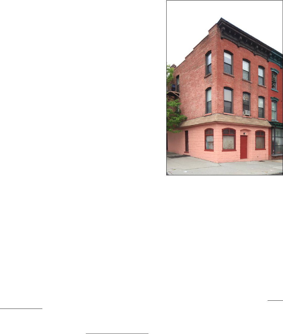
662 Driggs Avenue
Borough of Brooklyn Tax Map Block 2366 Lot 24
Date of Construction: c. 1867
Builder: Not Determined
Original Owner: Joseph A. Goeller
Type: Flats with store
Style: Italianate
Stories: Three
Material: Brick with stone trim
Ownership History to 1950:
1864 Joseph A. Goeller
1868 Michael Gesser
1869 Andrew Steinmuller and Ernst Boencke
1871 Ernst Boencke
1872 Valentine Nieting
History: This property was not part of Clock &
Miller’s plan but was developed at about the same
period. It appears that the three-story brick flats
building was erected in the late 1860s as an investment
property for Joseph A. Goeller, a shoemaker who lived and worked in a adjacent building (now
demolished) at 664 Driggs Avenue. The property subsequently passed through several owners
until Valentine Nieting acquired the building in 1872. Nieting—listed in directories as a tailor—
and his family resided in an apartment in this building for several decades. In the early 1890s his
daughter and son-in-law, Louise Marie Nieting and Heinrich Miller, moved to a flat on the upper
floor with their young son, the eventually famous author Henry Miller, Jr. The elder Miller also
worked as a tailor and was apparently employed as a cutter with his father-in-law. The Millers
lived at 662 Driggs Avenue for less than a decade, but the time proved to be a powerful memory
for young Henry. Reflecting on his life in a New York Times article from 1971, Miller recalled, “I
began my sojourn in Paradise in the first year of my life at 662 Driggs Avenue, Brooklyn, and I
remained there until 1899…these few years are ineradicably engraved in my mind.” By 1901 the
family had moved farther out in Brooklyn to the Bushwick neighborhood. Valentine Nieting and
his family appear to have retained ownership of the building at 662 Driggs Avenue for a number
of years.
Description: Three-story Italianate-style brick flats building with ground floor storefront. Main
(East) Façade: Three bays wide; ground floor has storefront with commercial entrance at center
and residential entrance at right; storefront flanked by brownstone pilasters, central entrance with
metal security gate recessed between large, single-pane windows, door has single large glass
18
panel; recessed residential entrance has historic wood door frame with plain reveal, rope molding
around frame and on transom bar, and three-pane transom light; ground floor separated from
upper floors by pressed metal cornice; upper floors have segmental-arched window openings
with stone lintels and sills; replica modillioned cornice supported by four acanthus-leaved
brackets with molded panel frieze. Side (North) Façade: Parged brick wall with single square
window opening at third story; coped parapet; stairway bulkhead visible above roofline from
street. Side (South) Façade: Parged brick wall with a rectangular window opening at second and
third stories; two light fixtures with conduit above second floor; coped parapet and two chimneys
visible from street. Alterations:
Recent building restoration included replacement of cornice,
window lintels, and sills with replicas based on historic photographs; entrance door replaced; all
historic windows replaced; light installed in door frame soffit; doorbells installed in left door
frame reveal.
References:
Kings County, Office of the Register, Liber Deeds and Conveyances.
Henry Miller, “A Boyhood View of the Nineties,” New York Times (October 17, 1971), A1.
New York City, Record of Tax Assessments, Brooklyn Ward 14, 1868-1898.
New York City, Division of Taxation, Tax Photographs, c. 1940.
United States Federal Census Records, 1860, 1870, 1880.
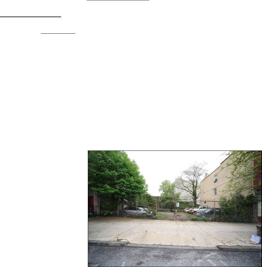
664 Driggs Avenue (aka 664-670 Driggs Avenue)
Borough of Brooklyn Tax Map Block 2366 Lot 25
Date of Construction: N/A
Architect: N/A
Original Owner: N/A
Type: Unimproved Lot
Style: N/A
Stories: N/A
Material: N/A
History: This property—once three
individual building lots—was not
part of Clock & Miller’s plan but
was developed during the same
period. A three-story brick
building once stood at the
northernmost lot, while a pair of
two-story frame structures occupied the southern lots. Joseph A. Goeller, a shoemaker, acquired
the brick building in 1863 and resided there until his death in 1902. He eventually purchased the
adjacent frame structures in 1880, consolidating ownership of the three parcels. Goeller’s
obituary in the Brooklyn Daily Eagle notes that he was “one of the oldest pioneer German
residents of the Eastern District” and “assisted in the development of that section of this
borough.” The buildings were demolished c. 1918; the lot has remained unimproved since.
Description: Unimproved lot enclosed with chain link fence.

19
References:
Obituary, Brooklyn Daily Eagle (January 16, 1902), 3.
Kings County, Office of the Register, Liber Deeds and Conveyances.
New York City, Record of Tax Assessments, Brooklyn Ward 14, 1868-1898.
New York City, Division of Taxation, Tax Photographs, c. 1940.
672 Driggs Avenue
Borough of Brooklyn Tax Map Block 2366 Lot 28
Date of Construction: c. 1868
Builder: Edward A. Woolley
Original Owner: Edward A. Woolley
Type: Flats with store
Style: Italianate
Stories: Three
Material: Brick with stone trim and wood cornice
Ownership History to 1950:
1866 Edward A. Woolley
1878 John H. Woolley
1880 Sarah E. Stewart
1887 William Ramsey
1912 Solomon Rosenberg
1920 Jacob Epstein
1922 Fannie Epstein
1923 Hannah Pittel
1925 Eva Dirsus
1926 Adele Markunas
1934 John G. and Nellie Mardosa
1940 Joseph M. Creamer
1947 Mary Gambale
1950 Regina Jacina
History: This property was not part of Clock & Miller’s plan but was developed at about the
same period. In the 1850s several parcels of land were conveyed by Philp J. Tuska to William B.
Foster, who in turn sold the lots to Edward A. Woolley in 1866. Woolley soon began
construction on a row of three flats buildings (now known as 672, 674, and 676 Driggs Avenue)
designed in the then-popular Italianate style. It appears that Woolley was his own contractor;
according to his obituary in the Brooklyn Daily Eagle, Woolley “went into the building business
in 1864 and since that time had built over two hundred houses” throughout Brooklyn. While the
property remained in the Woolley family’s ownership for several decades, passing to Edward’s
son John in 1878 and then to his married daughter Sarah E. Stewart in 1880, none of the family
ever resided here. Early tenants according to the 1880 United State census included William
Ramsey, a truckman (who eventually purchased the building in 1887), Sarah Thompson, a
boarder with the Ramseys, and Michael Hewatt, longshoreman.
20
Description: Three-story Italianate-style brick flats building with ground floor storefront. Main
(East) Façade: Three bays wide; ground floor has storefront with commercial entrance at left,
residential entrance at right, and storefront window at center; ground floor separated from upper
floors by pressed-metal cornice; upper floors have segmental-arched window openings with
radiating brick lintels and projecting stone sills; modillioned wood cornice supported by four
brackets with segmental-arched molded panel frieze. Side (North) Façade: Parged brick wall;
parapet with metal flashing. Site Features: Non-historic metal fence enclosing grade-level
areaway; areaway has concrete paving with metal cellar hatch at center. Alterations:
Ground
floor completely altered, commercial entrance at left altered to plain brick rectangular opening
with air-conditioning hole punched through façade above non-historic single-leaf door,
residential entrance set within plain brick opening with glass block transom and non-historic
single-leaf door, central storefront window replaced with glass block with an air-conditioning
unit punched through façade under glass block; original wood cornice above ground floor
replaced with pressed-metal version; original cast-iron window lintels on upper floors have been
removed; all historic windows replaced; façade has been painted; intercom and key box installed
in left door frame reveal of residential entrance, light installed in glass block transom.
References:
Obituary, Brooklyn Daily Eagle (June 18, 1899), 7.
Kings County, Office of the Register, Liber Deeds and Conveyances.
New York City, Record of Tax Assessments, Brooklyn Ward 14, 1868-1898.
New York City, Division of Taxation, Tax Photographs, c. 1940.
United States Federal Census Records, 1860, 1870, 1880.
674 Driggs Avenue
Borough of Brooklyn Tax Map Block 2366 Lot 29
Date of Construction: c. 1868
Builder: Edward A. Woolley
Original Owner: Edward A. Woolley
Type: Flats with store
Style: Italianate
Stories: Three
Material: Brick with stone trim and wood cornice
Ownership History to 1950:
1866 Edward A. Woolley
1878 John H. Woolley
1878 Sarah A. Woolley
1887 John Krapp
1893 Paul Sauer
1914 Abraham and Louis Schanman
1921 Morris Kampf
1924 Aaron Friedman
1924 Max Mances

21
History: This property was not part of Clock & Miller’s plan but was developed at about the
same period. In the 1850s several parcels of land were conveyed by Philp J. Tuska to William B.
Foster, who in turn sold the lots to Edward A. Woolley in 1866. Woolley soon began
construction on a row of three flats buildings (now known as 672, 674, and 676 Driggs Avenue)
designed in the then-popular Italianate style. It appears that Woolley was his own contractor;
according to his obituary in the Brooklyn Daily Eagle, Woolley “went into the building business
in 1864 and since that time had built over two hundred houses” throughout Brooklyn. While the
property remained in the Woolley family’s ownership for several decades, passing to Edward’s
son John in 1878 and then to his daughter Sarah the same year, none of the family ever resided
here. Early tenants according to the 1880 United State census included Louis Schwartz, merchant
tailor, Ferdinand Wirbarth, night watchman, and August Sieblist, larborer. The property, along
with its neighbor at 676 Driggs Avenue, was acquired in 1887 by John Krapp, a local wood
worker who owned and lived at 21 Fillmore Place. In the late nineteenth century John Borowski
operated a barber shop from the ground floor of the building. His son Stanley Borowski was an
intimate friend of author Henry Miller, who lived a few doors up the street at 662 Driggs Avenue
as a child.
Description: Three-bay, three-story Italianate-style brick flats building with ground floor
storefront; residential entrance at right has historic wood door frame with gridded transom light
and wood paneled single-leaf door with nine-pane light; ground floor separated from upper
floors by modillioned wood cornice; upper floors have segmental-arched window openings with
cast-iron lintels and projecting stone sills; modillioned wood cornice supported by four brackets
with segmental-arched molded panel frieze. Alterations: Ground floor storefront altered to
angled oriel window; all historic windows replaced; façade has been painted; doorbells installed
in left door frame reveal; light installed in underside of ground floor cornice above entrance.
References:
Obituary, Brooklyn Daily Eagle (June 18, 1899), 7.
Kings County, Office of the Register, Liber Deeds and Conveyances.
New York City, Record of Tax Assessments, Brooklyn Ward 14, 1868-1898.
New York City, Division of Taxation, Tax Photographs, c. 1940.
United States Federal Census Records, 1860, 1870, 1880.
22
676 Driggs Avenue (aka 187 North 1
st
Street)
Borough of Brooklyn Tax Map Block 2366 Lot 30
Date of Construction: c. 1868
Builder: Edward A. Woolley
Original Owner: Edward A. Woolley
Type: Flats with store
Style: Italianate
Stories: Three
Material: Brick with stone trim and wood cornice
Ownership History to 1950:
1866 Edward A. Woolley
1878 John H. Woolley
1878 Sarah A. Woolley
1887 John Krapp
1892 H. Julius Sauer
1910 Mary Matulewicz
1937 George Matulewicz
History: This property was not part of Clock &
Miller’s plan but was developed at about the same period. In the 1850s several parcels of land
were conveyed by Philp J. Tuska to William B. Foster, who in turn sold the lots to Edward A.
Woolley in 1866. Woolley soon began construction on a row of three flats buildings (now known
as 672, 674, and 676 Driggs Avenue) designed in the then-popular Italianate style. It appears that
Woolley was his own contractor; according to his obituary in the Brooklyn Daily Eagle, Woolley
“went into the building business in 1864 and since that time had built over two hundred houses”
throughout Brooklyn. While the property remained in the Woolley family’s ownership for
several decades, passing to Edward’s son John in 1878 and then to his daughter Sarah the same
year, none of the family ever resided here. Early tenants according to the 1880 United State
census included William Coffey, tailor, Volguard Magnussen, grocer, and Eide Vollers, a
grocery clerk who boarded with the Magnussens. The property, along with its neighbor at 674
Driggs Avenue, was acquired in 1887 by John Krapp, a local wood worker who owned and lived
at 21 Fillmore Place.
Description: Three-story Italianate-style brick flats building with ground floor storefront. Main
(East Façade): Three bays wide; altered ground floor storefront separated from upper floors by
cornice; upper floors have segmental-arched window openings with radiating brick lintels and
projecting stone sills; modillioned wood cornice supported by four brackets with segmental-
arched molded panel frieze. Side (South) Façade:
Storefront with cornice above wraps around
part of side façade; at ground story a segmental-arched window is located towards the front of
the building, a rectangular window with metal security grill is located towards center of the side
façade, and a rectangular entrance and a rectangular window with metal security grill are located
towards the rear of the building; one-story extension at rear of building has rectangular entrance,
rectangular window with metal security grill, and coped parapet; upper floors have three widely
spaced bays of segmental-arched window openings with radiating brick lintels and projecting

23
stone sills; coped parapet; chimney visible from street. Alterations: Ground floor completely
altered, now has central segmental-arched entrance flanked by segmental-arched window
openings; entrance has non-historic single-leaf door; ground floor has been stuccoed in faux-
stone pattern along main façade and part of side façade, remainder of side façade ground floor
stuccoed smooth; cornice separating ground floor from upper floors has been covered with
asphalt shingles; original cast-iron window lintels on upper floors have been removed; fire
escaped added to side façade; all historic windows replaced.
References:
Obituary, Brooklyn Daily Eagle (June 18, 1899), 7.
Kings County, Office of the Register, Liber Deeds and Conveyances.
New York City, Record of Tax Assessments, Brooklyn Ward 14, 1868-1898.
New York City, Division of Taxation, Tax Photographs, c. 1940.
United States Federal Census Records, 1860, 1870, 1880.
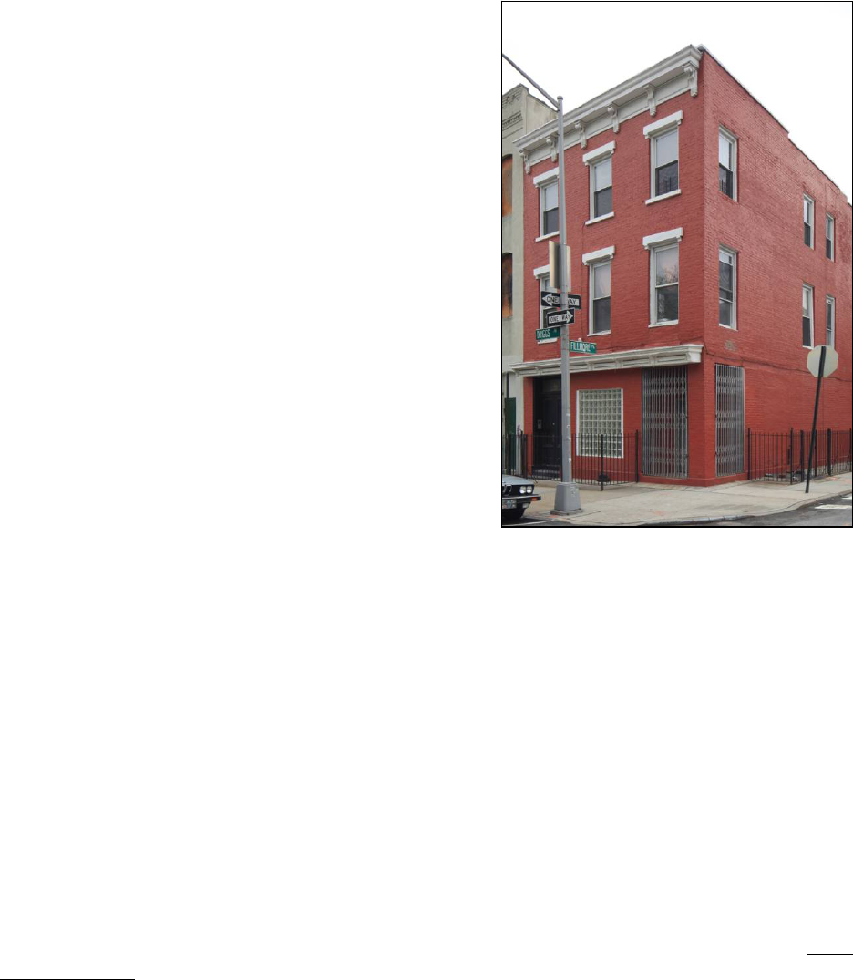
24
DRIGGS AVENUE, NO. 667 (EAST SIDE, BETWEEN FILLMORE PLACE AND
METROPOLITAN AVENUE)
667 Driggs Avenue (aka 1-5 Fillmore Place)
Borough of Brooklyn Tax Map Block 2367 Lot 1
Date of Construction: c. 1855
Builder: Not Determined
Original Owner: Charles M. Briggs
Type: Flats with store
Style: Italianate
Stories: Three
Material: Brick with stone trim and wood cornice
Ownership History to 1950:
1854 Charles M. Briggs
1855 James and Henry Kipling
1855 Richard Kipling
1906 Gumberg Realty Co.
1911 Mildred Levy
1917 Bernard Levy
1932 Sarah Levy
1944 Mildred Levy
History: This property was designated lot 2 on Clock and Miller’s “Map of 37 Lots” and was
originally known as 206 Fifth Street (later 187 Driggs Avenue). Clock and Miller conveyed the
property—along with lot 1, now known as 665 Driggs Avenue—in 1854 to Charles M. Briggs.
The deed from that sale notes that a brick stable already stood on the eastern end of the property,
on the section of the lot that is now part of the separate parcel known as 7 Fillmore Place
(partitioned off from 667 Driggs Street in 1974). Briggs subsequently mortgaged the property
back to Clock and Miller and it is likely that the three-story brick building that stands on the
property was erected at that time. Briggs soon sold the parcel to James and Henry Kipling in
1855, who in turn conveyed it to Richard Kipling the same year. It does not appear that Kipling
ever occupied the building himself; it was likely rented out as an investment. While the structure
is similar in design to those erected for Clock and Miller along Fillmore Place, there are a
number of notable differences. The building was built without a raised basement and stoop, and
instead has a ground floor storefront with a distinctive angled corner entrance. The property
remained in the possession of Kipling’s family for over five decades into the early twentieth
century.
Description: Three-story Italianate-style brick flats building with ground floor storefront. Main
(West) Façade: Three bays wide; ground floor storefront with commercial entrance recessed at
an angle at right on building’s corner, residential entrance at left; residential entrance retains
wood door frame with paneled reveal, single-paned transom light, and paneled double-leaf wood
doors; bracketed wood cornice with narrow molded frieze panels above storefront; upper floors
have rectangular window openings with bracketed stone lintels and projecting stone sills;

25
bracketed wood cornice with molded frieze panels. Side (South) Façade: Plain brick façade
punctured irregularly with window and door openings; ground floor has commercial entrance at
left, recessed at an angle on building corner; upper floors have four bays of rectangular window
openings without lintels or sills; brick parapet with stone coping; one-story extension at rear of
building has rectangular entrance with several vents punched through stuccoed façade of
extension. Rear (East) Façade: Portion of rear façade visible from street; parged brick wall with
plain rectangular window openings. Site Features: Non-historic metal fence enclosing grade-
level areaway in front of center and left bay on Driggs Avenue, areaway has concrete paving;
non-historic metal fence enclosing grade-level areaway along most of side façade on Fillmore
Place, areaway has concrete paving with metal cellar hatch at left. Alterations: Central storefront
window at ground floor filled with glass block; commercial entrance at building corner has new
door and frame, air-conditioning unit punched through façade above door, metal security grill;
recessed brick spandrels under second floor windows on main elevation rebuilt flush with
façade; on side façade, right-most entrance has been bricked in and air-conditioning unit punched
through infill in former opening, one bay of windows on upper floors has been bricked in,
window lintels and sills have been removed; all historic windows replaced and both façades have
been painted; intercom installed in left door frame reveal of residential entrance; telephone box
installed at right of Fillmore Place façade.
References:
Kings County, Office of the Register, Liber Deeds and Conveyances.
New York City, Record of Tax Assessments, Brooklyn Ward 14, 1868-1898.
New York City, Division of Taxation, Tax Photographs, c. 1940.
United States Federal Census Records, 1860, 1870, 1880.
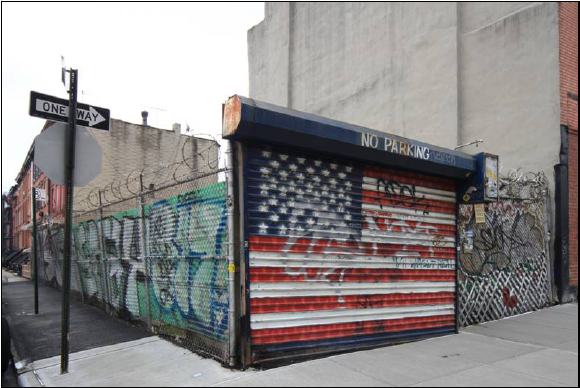
26
DRIGGS AVENUE, NOS. 673-675 (EAST SIDE, BETWEEN GRAND STREET AND
FILLMORE PLACE)
673 Driggs Avenue (aka 2-8 Fillmore Place)
Borough of Brooklyn Tax Map Block 2382 Lot 3
Date of Construction: N/A
Architect: N/A
Original Owner: N/A
Type: Unimproved Lot
Style: N/A
Stories: N/A
Material: N/A
History: This property was
designated lot 35 on Clock and
Miller’s “Map of 37 Lots” and was
originally known as 204 Fifth
Street (later 189 Driggs Avenue).
Clock and Miller sold the property
in 1852 to Enos J. Baker, who
eventually acquired adjacent lots at 675 Driggs Avenue and 10 Fillmore Place, as well as 17
Fillmore Place. A four-story flats building with a ground floor storefront was erected on the site
in the 1850s and it appears that Baker resided in one of the apartments for several years until he
lost the property in a foreclosure suit brought against him by the Board of Trustees of the Fire
Department Fund of the City of New York in 1866 (at which time he moved into an apartment
next door at 675 Driggs Avenue). The Gorman family, which operated a local grocery store,
acquired the property at auction following the suit and continued to posses it for several decades
into the twentieth century. The four-story building that once stood on the site was apparently
demolished in 1969.
Description: Unimproved lot enclosed with chain link fence along Fillmore Place and Driggs
Avenue; roll-down security gate on Driggs Avenue provides vehicular entrance to lot.
References:
Kings County, Office of the Register, Liber Deeds and Conveyances.
New York City, Record of Tax Assessments, Brooklyn Ward 14, 1868-1898.
New York City, Division of Taxation, Tax Photographs, c. 1940.

27
675 Driggs Avenue
Borough of Brooklyn Tax Map Block 2382 Lot 2
Date of Construction: c. 1855
Builder: Not Determined
Original Owner: John Hamilton
Type: Flats
Style: Altered Italianate
Stories: Three
Material: Brick with stone trim and wood cornice
Ownership History to 1950:
1852 John Hamilton
1856 Henry R. Prime
1858 Horace B. Claflin
1864 William H. Mellen
1866 Enos J. and Mary A. Baker
1895 Elizabeth White
1896 John McLaughlin
1896 David Michel
1898 Abraham and Esther Talalow
1906 Morris and Rose Barkan
1930 Ida Borenstein
1940 Kneeland Holding Corp.
1940 Anna and Mark Paradowski
1944 Anna and Kasimir Paradowski
1950 Gilberto and Felicita Torres
History: This property was designated lot 36 on Clock and Miller’s “Map of 37 Lots” and was
originally known as 202 Fifth Street (later 191 Driggs Avenue). Along with lot 37 (677 Driggs
Avenue), Clock and Miller sold the property in 1852 John Hamilton, who already owned an
adjacent parcel along Grand Street. In September 1855, Hamilton took out a mortgage on the
property with merchant Horace B. Claflin—who was partner in the firm of Claflin, Mellen &
Co., one of the largest wholesalers in New York City during the mid-nineteenth century. It is
likely that the three-story structure that stands on the property—once part of a row of three
similar buildings at 675-679 Driggs Avenue—was erected at this time. Hamilton soon conveyed
all three properties to Henry R. Prime in 1856. Two years later in 1858 they passed into the
hands of Claflin, possibly in an informal foreclosure proceeding. The property was later
conveyed to Claflin’s associate William H. Mellen in 1864. In 1866, he partitioned the property
and sold off individual buildings; 675 Driggs Avenue was purchased by Enos J. and Mary A.
Baker, who already owned property in the area at 673 Driggs Avenue, 10 Fillmore Place, and 17
Fillmore Place. The Bakers sold or lost most of their neighborhood holdings by the early 1870s,
but retained possession of this building for several decades. Census records indicate they
occupied one of the apartments while the remaining space was rented out to other families. The
Bakers eventually lost this property as well during a foreclosure suit brought by Elizabeth White

28
in 1895. The building has subsequently been altered; the upper floors have been reclad and the
ground floor storefront removed.
Description: Three-story Italianate-style brick flats building. Main (West) Façade:
Three bays
wide; altered ground floor separated from upper floors by corbelled brick cornice; upper floors
have rectangular window openings with molded stone lintels and projecting stone sills; bracketed
wood cornice with molded panel frieze. Side (South) Façade:
Parged brick wall; steel reinforcing
beams attached to exterior of wall; parapet with metal flashing. Side (North) Façade: Parged
brick wall; one-story extension at rear of building. Rear (East) Façade:
Parged brick wall with
plain rectangular window openings; fire ladder along center bay. Alterations:
Ground floor
completely altered, now has round-arched entrance at right and three rectangular window
openings to left; cornice separating ground floor from upper stories has been removed; upper
floors refaced with faux-brick finish; center lintel on second story shaved off, fire escape added;
all historic windows replaced.
References:
Kings County, Office of the Register, Liber Deeds and Conveyances.
New York City, Record of Tax Assessments, Brooklyn Ward 14, 1868-1898.
New York City, Division of Taxation, Tax Photographs, c. 1940.
United States Federal Census Records, 1860, 1870, 1880.

29
FILLMORE PLACE, NOS. 1-23 (NORTH SIDE, BETWEEN DRIGGS AVENUE AND
ROEBLING STREET)
1-5 Fillmore Place
See: 667 Driggs Avenue
7 Fillmore Place
Borough of Brooklyn Tax Map
Block 2367 Lot 43
Date of Construction: 1912
Architect: Not Determined
Original Owner: Mildred Levy
Type: Garage
Style: Altered Colonial Revival
Stories: Two
Material: Brick
Ownership History to 1950:
1911 Mildred Levy
1917 Bernard Levy
1932 Sarah Levy
1944 Mildred Levy
History: This lot was connected with 667 Driggs Avenue until it was partitioned off in 1974. It
appears that an earlier structure once stood on the property throughout much of the nineteenth
century. The deed of sale for the lot from Clock and Miller to Charles M. Biggs in 1854 notes
that a brick stable stood at the southeast corner of the parcel. That building was demolished
around the turn of the twentieth century. The current structure was erected in 1912, just after the
Levy family acquired the property.
Description: Two-story brick garage. Main (South) Façade:
Three bays wide; horizontal brick
banding across façade; at ground floor, rectangular vehicular entrance at left, window opening at
center, residential entrance and small window opening to right; vehicular entrance has metal
lintel; window openings have radiating stone lintels with keystones and projecting stone sills;
residential entrance has similar radiating stone lintel with keystone; historic door frame with
double-paned transom light; upper floor originally had three regularly placed rectangular
window openings with radiating stone lintels with keystones and projecting stone sills; simple
corbelled brick cornice with frieze panels composed of recessed brick; stone coping. Side (West)
Façade: Portion of side façade visible from street level; parged brick wall; single segmental-
arched window openings at second floor. Side (East) Façade: Portion of side façade visible from
street level; parged brick wall. Site Features:
Non-historic metal fence enclosing grade-level
areaway in front of center and right bays; areaway has concrete paving. Alterations: Vehicular
entrance now has metal roll-down security gate; pedestrian entrance has non-historic door and
metal security gate; window openings at ground floor have metal security grilles installed; on
upper story, left opening has been enlarged for double-width French door and right opening
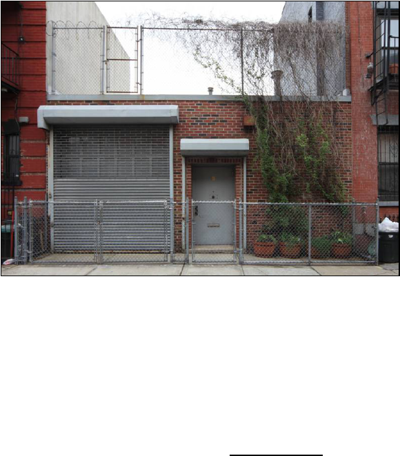
30
enlarged for single-door; metal balcony added to second story, supported by metal brackets
attached to building façade, covered with fixed metal awning; all historic windows replaced;
mailbox installed on façade to left of pedestrian entrance; lights installed on façade on both sides
of vehicular entrance.
References:
Kings County, Office of the Register, Liber Deeds and Conveyances.
New York City, Record of Tax Assessments, Brooklyn Ward 14, 1868-1898.
New York City, Division of Taxation, Tax Photographs, c. 1940.
9 Fillmore Place
Borough of Brooklyn Tax Map
Block 2367 Lot 42
Date of Construction: c. 1934
Architect: Not Determined
Original Owner: Sarah Levy
Type: Garage
Style: None
Stories: One
Material: Brick
Ownership History to 1950:
1932 Sarah Levy
1944 Mildred Levy
History: This lot was connected with 11 Fillmore Place until it was partitioned off in 1970. The
site remained unimproved throughout the nineteenth century. A wood-framed wagon shed was
erected on the lot c. 1934. The structure has since been heavily altered, including the addition of
a new brick façade.
Description: One-story brick garage; plain brick façade with rectangular pedestrian entrance at
center and rectangular vehicular entrance at left; metal roll-down security gates above both
entrances; metal flashing at roofline, chain-link fence above façade. Site Features:
Chain-link
fence enclosing grade-level areaway; areaway has concrete paving.
References:
Kings County, Office of the Register, Liber Deeds and Conveyances.
New York City, Record of Tax Assessments, Brooklyn Ward 14, 1868-1898.
New York City, Division of Taxation, Tax Photographs, c. 1940.

31
11 Fillmore Place
Borough of Brooklyn Tax Map Block 2367 Lot 41
Date of Construction: 1881
Architect: Not Determined
Original Owner: Samuel W. Woolsey
Type: Flats
Style: Neo-Grec
Stories: Three and basement
Material: Brick with stone trim and wood cornice
Ownership History to 1950:
1880 Samuel W. Woolsey
1916 Barnett Levy
1932 Sarah Levy
1944 Mildred Levy
History: This property corresponds approximately to
lot 5 on Clock and Miller’s “Map of 37 Lots.” While
most of Fillmore Place was developed during the
1850s, this parcel remained unimproved for several
decades. Clock and Miller sold the lot in 1854 to
William Flanagan, who in turn conveyed it to John Lynch in 1872. Samuel W. Woolsey acquired
the property in 1880 and soon commissioned a three-story brick flat building for the site,
designed in the then-popular neo-Grec style. The building’s cornice is particularly characteristic
of the style, with incised brackets, heavy modillions, and dentil course. The Woolsey family
retained ownership of the building for several decades until the Levy family, which already
owned the adjacent property at 667 Driggs Avenue, acquired it in 1916.
Description: Three-story neo-Grec-style brick flats building with shallow raised basement. Main
(South) Façade: Three bays wide; short stoop leads to entrance at right; recessed entrance
enframement has molded stone hood and brick reveal; rectangular window openings with
molded stone lintels and projecting stone sills; basement separated from ground floor by stone
belt course; basement has small rectangular window openings; projecting wood cornice with
dentil and modillion courses supported by paired, incised brackets. Side (West) Façade: Plain
brick façade with single rectangular opening with radiating brick lintel set in chimney. Side
(East) Façade: Mostly parged brick wall. Site Features: Historic wrought-iron fence and gate
with cast-iron details enclosing grade-level areaway; areaway has concrete paving with tree box
at left. Alterations:
Window lintels on first and second story have been shaved down; stoop
resurfaced, railing replaced; entrance door frame and door replaced; metal security grilles
installed on ground floor window openings; all historic windows replaced; fire escape added;
intercom and key box installed in left brick entrance enframement reveal; lights installed on door
frame face on both sides of transom.
References:
Kings County, Office of the Register, Liber Deeds and Conveyances.

32
New York City, Record of Tax Assessments, Brooklyn Ward 14, 1868-1898.
New York City, Division of Taxation, Tax Photographs, c. 1940.
United States Federal Census Records, 1860, 1870, 1880.
13 Fillmore Place
Borough of Brooklyn Tax Map Block 2367 Lot 40
Date of Construction: c. 1854
Builder: Not Determined
Original Owner: Henry R. Richardson
Type: Flats
Style: None
Stories: Two
Material: Frame structure with faux-stone facing
Ownership History to 1950:
1854 Henry R. Richardson
1857 Elizabeth and George W. Taylor
1868 William H. Bowerhan
1917 Joseph H. Carpenter
1919 William D. and Henriette Van Vorst
History: This property was designated lot 6 on Clock
and Miller’s “Map of 37 Lots.” Clock and Miller sold
the property in 1854 to Henry C. Richardson. The
building appears to have been erected shortly
afterwards. Its two-story height and frame structure make it unique amongst the houses built
along Fillmore Place. Richardson in turn sold the property to Elizabeth Taylor in 1857. The
Taylors occupied one of the apartments in the building for nearly a decade and apparently rented
out the remaining space to other families; other early tenants according to the 1860 United States
Census included William Graham, plate printer, and his wife Eliza. In 1868 the building was
acquired by William H. Browerhan, a saw maker. It remained in their family for several decades
into the early twentieth century. The building has subsequently been altered and a new façade
added.
Description: Three-bay, two-story frame flats building with shallow raised basement; stoop leads
to entrance at left; rectangular window opening to right; upper floor has rectangular window
openings; basement level has two small rectangular window openings; crenellated parapet with
metal flashing. Site Features:
Non-historic metal fence enclosing stoop and grade-level areaway;
areaway has concrete paving. Alterations: Façade stripped of all historic material, including
original cornice, lintels and window enframements, and pedimented door hood; façade stuccoed
in faux-stone pattern; stoop replaced and realigned; entrance door frame and door replaced; all
historic windows replaced; historic cast-iron areaway railing replaced; all historic windows
replaced.

33
References:
Kings County, Office of the Register, Liber Deeds and Conveyances.
New York City, Record of Tax Assessments, Brooklyn Ward 14, 1868-1898.
New York City, Division of Taxation, Tax Photographs, c. 1940.
United States Federal Census Records, 1860, 1870, 1880.
15 Fillmore Place
Borough of Brooklyn Tax Map Block 2367 Lot 39
Date of Construction: c. 1853
Builder: Not Determined
Original Owner: Benjamin R. Davis
Type: Flats
Style: None
Stories: Three and basement
Material: Brick
Ownership History to 1950:
1853 Benjamin R. Davis
1862 Jeremiah V. Meserole
1864 Julia A. and Wentworth K. Stodder
1888 Rose Gorman
1891 John McCrystal
1892 Isidor Michel
1894 Max Lippmann
1897 Isidor Michel
1906 Samuel Fischer
1922 Helen Flachs and Peppi Tuchfeld
1922 Samuel Fischer
1924 Joseph Bologna
1924 Solomon Sandler
1925 Vincenty and Fanciska Golenda
History: This property was designated lot 7 on Clock and Miller’s “Map of 37 Lots” and was
originally known as 14 Fillmore Place. Clock and Miller sold the property in 1853 to Benjamin
R. Davis. The building appears to have been erected shortly afterwards and it initially shared a
similar design with its neighbor at 17 Fillmore Place. It appears that Davis—who is listed in city
directories as a grocer living in Brooklyn Heights—rented out the building as an investment.
Amongst its early tenants according to the 1860 United States Census were Michael Donevan,
butcher, and Samuel Conrow, engineer. Davis sold the property in 1862 to Alfred Clock’s son-
in-law, Jeremiah V. Meserole. Julia A. Stodder acquired the building in 1864 and her family
continued to reside in one of the apartments for over twenty years. The building was heavily
altered in the early 1960s.
Description: Three-story brick flats building with raised basement. Main (South) Façade: Three
bays wide; entrance at right in basement; rectangular window openings with projecting brick
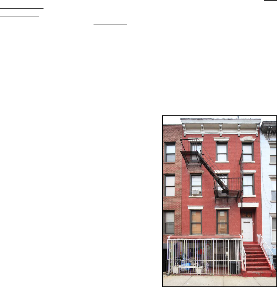
34
sills; basement separated from ground floor by brick corbelling; basement level has simple
rectangular window openings; simple corbelled brick cornice; stone coping at roofline. Side
(West) Façade: Portion of side façade visible from street level; parged brick wall; coped parapet.
Site Features:
Non-historic metal fence enclosing sunken areaway; areaway has concrete paving
with metal cellar hatch at left. Alterations:
Façade stripped of all historic material, including
original cornice, lintels and sills, and molded door hood; new brick façade added; stoop
removed, entrance now at basement level; fixed metal awning installed over entrance; door and
frame replaced; metal security grilles installed on basement windows; historic cast-iron areaway
fence replaced; all historic windows replaced.
References:
Kings County, Office of the Register, Liber Deeds and Conveyances.
New York City, Record of Tax Assessments, Brooklyn Ward 14, 1868-1898.
New York City, Division of Taxation, Tax Photographs, c. 1940.
United States Federal Census Records, 1860, 1870, 1880.
17 Fillmore Place
Borough of Brooklyn Tax Map Block 2367 Lot 38
Date of Construction: c. 1853
Builder: Not Determined
Original Owner: Enos J. Baker
Type: Flats
Style: Italianate
Stories: Three and basement
Material: Brick with stone trim and wood cornice
Ownership History to 1950:
1852 Enos J. and Mary A. Baker
1866 Henry and Alice Hale
1906 Frank A. and Adelaide Treiling
1921 Simon and Margaret Pociunas
1922 Michael and Anna Bartkus
1924 Anna Ditko
1926 Joseph and Barbara Mureika
1950 Mary M. Stanis
History: This property was designated lot 8 on Clock
and Miller’s “Map of 37 Lots” and was originally known as 12 Fillmore Place. Clock and Miller
sold the property in 1852 to Enos J. Baker. The building appears to have been erected shortly
afterwards and it once shared a similar design with its neighbor at 15 Fillmore Place before that
structure was altered. Baker also acquired the property at 673 Driggs Avenue at about the same
time, and he eventually purchased 675 Driggs Avenue and 10 Fillmore Place as well. It appears
that many of these properties—including this one—were rented out as investments from the
beginning. Amongst its early tenants according to the 1860 United States Census were Charles
Townsend, tinsmith, Richard Latimer, clerk, and Daniel Maujer, painter. In 1866, Baker lost the
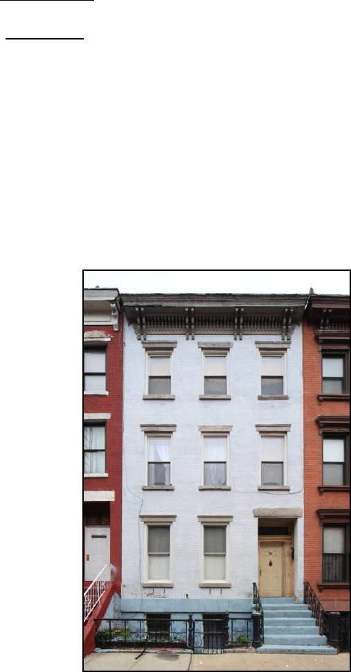
35
property in a foreclosure suit brought against him by the Williamsburgh Savings Bank. Henry
Hale—listed in census records as a store clerk—acquired the property at auction following the
court action; his family owned the building for several decades into the early twentieth century.
Description: Three-bay, three-story Italianate-style brick flats building with raised basement;
stoop leads to entrance at right; recessed entrance enframement has stone lintel and brick reveal;
door frame has double-pane transom light and paneled single-leaf door; rectangular window
openings with molded stone lintels and projecting stone sills; basement has simple rectangular
window openings; portions of historic iron security grilles at basement level remain; bracketed
wood cornice with molded frieze panels. Site Features: Non-historic metal fence and metal
awning fully enclosing grade-level areaway; areaway has concrete paving with stairs at right
leading to basement entrance under stoop. Alterations: Basement level refaced with textured
stucco; metal awning added separating basement level from ground floor; stoop rebuilt, railing
replaced; areaway rebuilt to grade level; several lintels have been shaved down, left lintel on
second story completely removed and replaced with brick; molded hood above entrance has been
shaved down; entrance door frame and door replaced; all historic windows replaced; fire escape
added; façade painted.
References:
Kings County, Office of the Register, Liber Deeds and Conveyances.
New York City, Record of Tax Assessments, Brooklyn Ward 14, 1868-1898.
New York City, Division of Taxation, Tax Photographs, c. 1940.
United States Federal Census Records, 1860, 1870, 1880.
19 Fillmore Place
Borough of Brooklyn Tax Map Block 2367 Lot 37
Date of Construction: c. 1853
Builder: Not Determined
Original Owner: Thomas Coger
Type: Flats
Style: Italianate
Stories: Three and basement
Material: Brick with stone trim and wood cornice
Ownership History to 1950:
1852 Thomas Coger
1888 Ann E. Mills
1923 Andrew and Anna Kulawy
History: This property was designated lot 9 on Clock
and Miller’s “Map of 37 Lots” and was originally
known as 10 Fillmore Place. Clock and Miller sold the
property in 1852 to Thomas Coger. The building
appears to have been erected shortly afterwards and
shares a similar design with its neighbors at 21 and 23

36
Fillmore Place. Coger’s family occupied one of the apartments in this building for several
decades; directories and census list Coger as a shipjoiner. He apparently rented out the remaining
space to other families; early tenants according to the 1860 United States Census included John
Schuller, an artist, and his wife Matilda. Coger sold the building in 1888 to Ann E. Mills, who
previously had rented an apartment across the street at 10 Fillmore Place according to the 1880
census.
Description: Three-bay, three-story Italianate-style brick flats building with raised basement;
stoop with wrought-iron railing, cast-iron newels and newel posts leads to entrance at right;
recessed entrance enframement has stone lintel and brick reveal; wood door frame with paneled
reveal, pilasters, and single-pane transom light; rectangular window openings with molded stone
lintels and projecting stone sills; basement separated from ground floor by stone belt course;
basement level has simple rectangular window openings with historic iron security grilles;
modillioned wood cornice supported by paired, scroll-sawn brackets. Site Features:
Non-original
wrought-iron fence and gate with stone edging topped with cinder blocks enclosing sunken
areaway; areaway has stuccoed paving with stairs at right leading to basement entrance under
stoop; hatch in front of left bay; built-in planter at left of areaway. Alterations:
Stoop resurfaced,
newel post caps have been removed; areaway fence replaced; several window lintels have been
shaved down; molded hood above entrance has been shaved down; entrance door replaced; all
historic windows replaced; façade painted; doorbells installed on right face of door frame;
mailbox installed on right door frame reveal; brackets for window planter boxes installed under
first floor windows.
References:
Kings County, Office of the Register, Liber Deeds and Conveyances.
New York City, Record of Tax Assessments, Brooklyn Ward 14, 1868-1898.
New York City, Division of Taxation, Tax Photographs, c. 1940.
United States Federal Census Records, 1860, 1870, 1880.
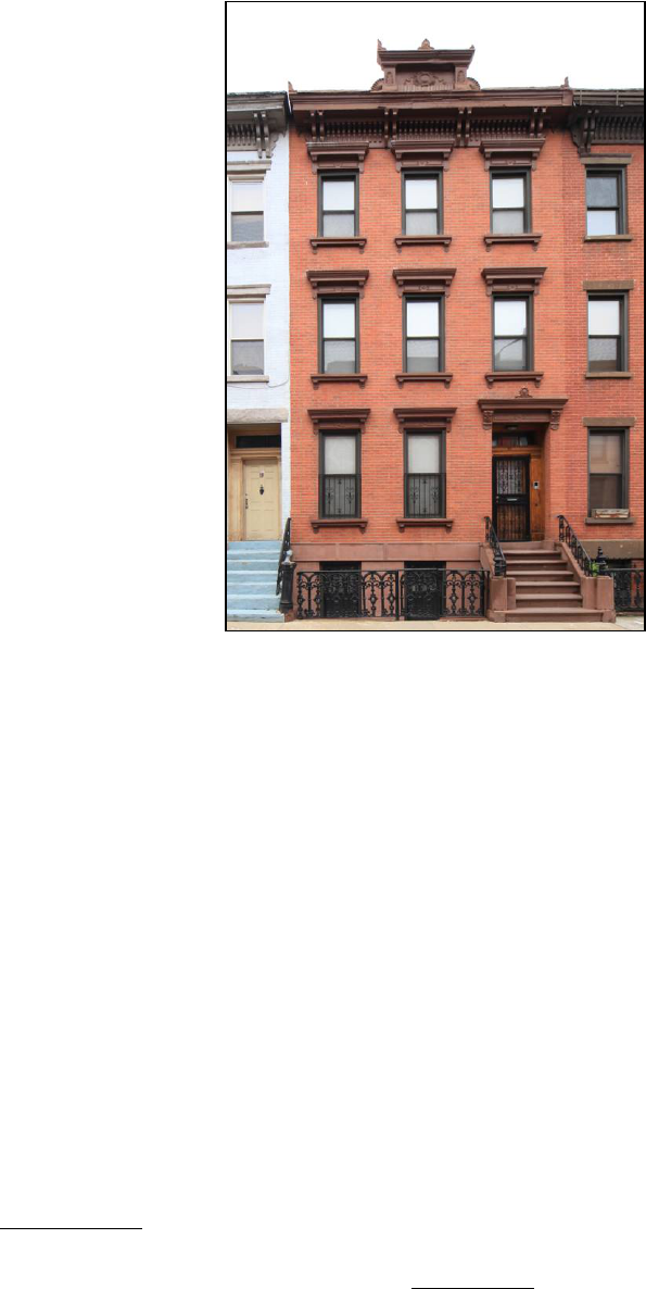
37
21 Fillmore Place
Borough of Brooklyn Tax Map Block 2367 Lot 36
Date of Construction: c. 1853
Builder: Not Determined
Original Owner: Samuel G. Baxter
Type: Flats
Style: Italianate
Stories: Three and basement
Material: Brick with stone trim and wood cornice
Ownership History to 1950:
1853 Samuel G. Baxter
1858 Bridget Wickham
1860s John Krapp
1905 Henry and Anna Wucherpfennig
1919 George and Yadwiga Prizgint
1924 Wladyslaw and Weronika Lewaszkiewicz
History: This property was designated lot 10 on Clock
and Miller’s “Map of 37 Lots” and was originally
known as 8 Fillmore Place. Clock and Miller sold the
property in 1853 to Samuel G. Baxter. The building appears to have been erected shortly
afterwards and shares a similar design with its neighbors at 19 and 23 Fillmore Place. Baxter in
turn sold the property to Bridget Wickham in 1858. It appears that this building was rented out at
that time as an investment. Amongst its early tenants according to the 1860 United States Census
were William T. Burns, printer, George G. Wilkins, ship carpenter, and Grace M. Simmons,
milliner. The property was eventually acquired by John Krapp, whose family occupied one of the
apartments for several decades into the early twentieth century. Krapp is listed in directories and
census records as a wood carver. He eventually invested in real estate elsewhere in the Fillmore
Place Historic District, acquiring 674 and 676 Driggs Avenue in 1887.
Description: Three-bay, three-story Italianate-style brick flats building with raised basement;
stoop with wrought-iron railing, cast-iron newels and newel posts partially encased in stucco
leads to entrance at right; recessed entrance enframement has bracketed cast-iron hood and brick
reveal; wood door frame with paneled reveal, pilasters, three-pane transom light, and paneled
single-leaf door with rectangular light; rectangular window openings with bracketed cast-iron
lintels and projecting, bracketed cast-iron sills; basement separated from ground floor by
stuccoed stone belt course; basement level has simple rectangular window openings with historic
iron security grilles; modillioned wood cornice supported by paired, scroll-sawn brackets; cast-
iron frontispiece above center bay. Site Features:
Historic wrought-iron fence and gate with cast-
iron newels enclosing sunken areaway; areaway has stuccoed paving with stairs at right leading
to basement entrance under stoop; stand pipe located at left of areaway. Alterations:
Basement
level and belt course have been stuccoed; stoop resurfaced, cast-iron newels and newel posts
partially encased in stucco; metal security gate added to main entrance; half-height metal
security grilles installed on first floor window openings; anti-bird devices installed above
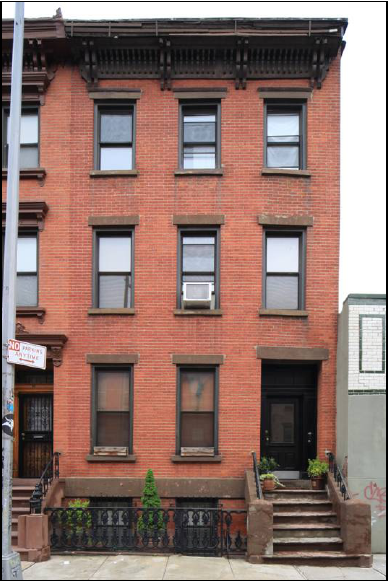
38
cornice, frontispiece, entrance hood, window lintels on second and third floors, and third floor
window sills; all historic windows replaced; light installed in door frame soffit; intercom
installed on right face of door frame.
References:
Kings County, Office of the Register, Liber Deeds and Conveyances.
New York City, Record of Tax Assessments, Brooklyn Ward 14, 1868-1898.
New York City, Division of Taxation, Tax Photographs, c. 1940.
United States Federal Census Records, 1860, 1870, 1880.
23 Fillmore Place
Borough of Brooklyn Tax Map Block 2367 Lot 35
Date of Construction: c. 1853
Builder: Not Determined
Original Owner: William C. Fowler
Type: Flats
Style: Italianate
Stories: Three and basement
Material: Brick with stone trim and wood cornice
Ownership History to 1950:
1853 William C. Fowler
1862 Anna B. Holmes
1867 Jane A. Bowdery
1900 Emma J. Bowdery
1920 Bernard and Petrunela Zinis
1920 George and Anna Warnaitis
1929 William and Irene Snegirewich
1943 Eugenia Dmitrioff and Elaine Liquori
History: This property was designated lot 11 on Clock
and Miller’s “Map of 37 Lots” and was originally known as 6 Fillmore Place. Clock and Miller
sold the property in 1853 to William C. Fowler. The building appears to have been erected
shortly afterwards and shares a similar design with its neighbors at 19 and 21 Fillmore Place.
Fowler resided in one of building’s apartments for nearly a decade; he is listed in directory and
census records as a carpenter or ship carpenter. Folwer apparently rented out the remaining space
to other families—early tenants according to the 1860 United States Census included Henry
Anstey, grocer, and Thomas J. Newman, painter. Fowler lost the building in 1862 during a
foreclosure suit to Anna B. Holmes, a real estate investor who held mortgages on several of the
houses on Fillmore Place. In 1867 the property was acquired by Jane A. Bowdery and it
remained in her family’s possession for the next half century.
Description: Three-bay, three-story Italianate-style brick flats building with raised basement;
stoop with wrought-iron railing, cast-iron newels partially encased in stucco, and fully stuccoed
newel posts leads to entrance at right; recessed entrance enframement has stone lintel and brick

39
reveal; wood door frame with paneled reveal, pilasters, three-pane transom light, and paneled
single-leaf door with rectangular light; rectangular window openings with molded stone lintels
and projecting stone sills; basement separated from ground floor by stone belt course; basement
level has simple rectangular window openings; modillioned wood cornice supported by paired,
scroll-sawn brackets. Side (East) Façade: Parged brick wall. Site Features: Historic wrought-iron
fence and gate with cast-iron newels and brownstone edging enclosing sunken areaway; areaway
has bluestone paving with stairs at right leading to basement entrance under stoop; non-historic
metal security gate under stoop. Alterations: Stoop resurfaced, cast-iron newels partially encased
in stucco, cast-iron newel posts completely encased in stucco; window lintels on first and second
stories have been shaved down; anti-bird devices installed above cornice and third-story window
lintels; security grilles on basement windows replaced; all historic windows replaced; light
installed in left door frame reveal; doorbells installed on face of right door frame.
References:
Kings County, Office of the Register, Liber Deeds and Conveyances.
New York City, Record of Tax Assessments, Brooklyn Ward 14, 1868-1898.
New York City, Division of Taxation, Tax Photographs, c. 1940.
United States Federal Census Records, 1860, 1870, 1880.

40
FILLMORE PLACE, NOS. 2-32 (SOUTH SIDE, BETWEEN DRIGGS AVENUE AND
ROEBLING STREET)
2-8 Fillmore Place
See: 673 Driggs Avenue
10 Fillmore Place
Borough of Brooklyn Tax Map Block 2382 Lot 4
Date of Construction: 1873
Builders: Jacob Sheppard and John Rourke (attributed)
Original Owner: Josiah Blackwell
Type: Flats
Style: Italianate
Stories: Three
Material: Brick with stone trim and wood cornice
Ownership History to 1950:
1872 Josiah Blackwell
1885 Margaret Lawler
1915 Frank and Pauline Kristunas
1950 Charles and Anna Christunas
History: This property was designated lot 34 on Clock
and Miller’s “Map of 37 Lots.” Clock and Miller sold
the lot in 1867 to Enos J. and Mary A. Baker, who
already owned 673 Driggs Avenue and 17 Fillmore
Place and who would soon acquire 675 Driggs
Avenue. The Bakers in turn sold the property to Josiah Blackwell in 1872. Shortly thereafter
Blackwell commissioned a three-story brick building on the site. While the name of the builder
has not been determined conclusively, 10 Fillmore Place was erected soon after a nearly identical
structure was completed at 30 Fillmore Place by Jacob Sheppard and John Rourke—the
contractors responsible for most of the buildings along the southern side of Fillmore Place.
While the structure is similar in design to those erected in the 1850s for Clock and Miller, there
are a number of differences; most notably, the building lacks a raised basement and stoop,
instead placing its parlor floor at grade level. Blackwell apparently rented out the building as an
investment—according to the 1880 United States Census three families lived in the building.
Tenants included Malcolm Ritchey, ship carpenter, William Mills, house painter, and James
Bebee, cooper. Blackwell sold the property in 1885 to Margaret Lawler, whose family owned the
building for several decades into the early twentieth century.
Description: Three-story Italianate-style brick flats building. Main (North) Façade: Three bays
wide; single stuccoed step leads to entrance at left; recessed entrance enframement has
pedimented stone hood and brick reveal; rectangular window openings with molded stone lintels
and projecting stone sills; bracketed wood cornice with molded frieze panels. Side (West)
Façade: Parged brick wall with single small rectangular window opening at second story. Site
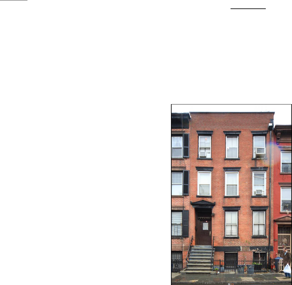
41
Features: Historic cast-iron railing enclosing grade-level areaway; areaway has concrete paving,
metal hatch in front of center bay, and a stand pipe to the right of entrance. Alterations: Historic
cast-iron hand railings and newel posts at entrance replaced; entrance door frame and door
replaced; metal security gate added to main entrance; metal security grilles installed on first floor
window openings; all historic windows replaced; façade painted; mailbox installed on left door
frame reveal; doorbells installed on right door frame reveal; light installed in door frame soffit.
References:
Kings County, Office of the Register, Liber Deeds and Conveyances.
New York City, Record of Tax Assessments, Brooklyn Ward 14, 1868-1898.
New York City, Division of Taxation, Tax Photographs, c. 1940.
United States Federal Census Records, 1860, 1870, 1880.
12 Fillmore Place
Borough of Brooklyn Tax Map Block 2382 Lot 5
Date of Construction: c. 1854
Builder: Jacob Sheppard
Original Owner: Clock and Miller
Type: Flats
Style: Italianate
Stories: Three and basement
Material: Brick with stone trim and wood cornice
Ownership History to 1950:
1846 Alfred Clock and Ephraim Miller
1859 Rebecca Sheppard
1861 Charles Maujer
1862 Charles W. Maujer
1863 Stephen Squier
1865 Charlotte Letscher
1900 Elizabeth Letscher
1912 Edward and Margaret Fine
1925 Peter Jr., Beatrice, and Joseph Bernaletti
1928 Peter Benaletti, Sr.
1945 Guttilla Realty Co., Inc.
1946 Stefano and Salvatore Leocato
History: This property was designated lot 33 on Clock and Miller’s “Map of 37 Lots” and was
originally known as 19 Fillmore Place. It appears that the building was erected in the mid 1850s
by Jacob Sheppard, a mason who had been commissioned by Clock and Miller to erect most of
the houses along the southern side of Fillmore Place. In 1859 the building was acquired by
Rebecca Sheppard, Jacob’s wife—possibly as part of the builder’s compensation. The Sheppards
sold the building in 1861 to Charles Maujer, a prominent dealer of building materials, and it
passed through several hands during the early 1860s before being acquired by Charlotte Letscher
in 1865. Census records from 1860 indicate the Letscher family had already moved into an

42
apartment in the building prior to their purchase of it. Charlotte’s husband, Adam Letscher, is
listed as a hatter and at least one of their daughters also worked as a hat trimmer. Other early
tenants included John Schmitt, also a hatter, and John W. Shortell, a printer. The Letscher family
continued to own the property into the twentieth century.
Description: Three-bay, three-story Italianate-style brick flats building with raised basement;
stoop with wrought- and cast-iron railing leads to entrance at left; recessed entrance
enframement has pedimented stone hood and brick reveal; wood door frame with paneled reveal,
dentiled transom bar, and single-paned transom light; rectangular window openings with molded
stone lintels and projecting stone sills; historic double hung two-over-two windows on first and
third stories; basement separated from ground floor by stuccoed stone belt course; basement
level has simple rectangular window openings with historic iron security grilles; brick parapet at
roofline. Site Features: Non-historic metal fence with brownstone edging enclosing slightly
sunken areaway; areaway has concrete paving with stairs at left leading to basement entrance
under stoop; hatch in front of right bay; bluestone paving on sidewalk in front of house.
Alterations: Stoop resurfaced, cast-iron newel posts removed; historic cast-iron areaway fence
replaced; brickwork below ground floor windows and between basement windows rebuilt;
historic wood cornice removed and replaced with brick parapet; entrance door replaced; historic
widows replaced on second story; storm windows installed over historic windows on first and
third floors; gutter attached to right side of façade; mailbox installed on left door frame reveal;
light installed on building façade to right of entrance; doorbells installed on right face of door
frame.
References:
Kings County, Office of the Register, Liber Deeds and Conveyances.
New York City, Record of Tax Assessments, Brooklyn Ward 14, 1868-1898.
New York City, Division of Taxation, Tax Photographs, c. 1940.
United States Federal Census Records, 1860, 1870, 1880.
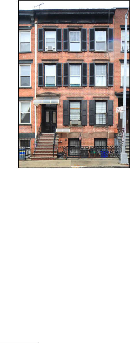
43
14 Fillmore Place
Borough of Brooklyn Tax Map Block 2382 Lot 6
Date of Construction: c. 1854
Builder: Jacob Sheppard
Original Owner: Clock and Miller
Type: Flats
Style: Italianate
Stories: Three and basement
Material: Brick with stone trim and wood cornice
Ownership History to 1950:
1846 Alfred Clock and Ephraim Miller
1859 Rebecca Sheppard
1860 Clock and Miller
1868 Theodore J. Miller
1868 Lawrence G. Faxen
1885 James J. Nash
1904 James Gartland
1918 Peter and Anna Winslow
1920 Anthony and Amelia Brazaitys
1927 Anna Daniels
1944 Lee Adelaide
1947 Sam and Anna Krasnicky
History: This property was designated lot 32 on Clock and Miller’s “Map of 37 Lots” and was
originally known as 17 Fillmore Place. It appears that the building was erected in the mid 1850s
by Jacob Sheppard, a mason who had been commissioned by Clock and Miller to erect most of
the houses along the southern side of Fillmore Place. In 1859 the building was acquired by
Rebecca Sheppard, Jacob’s wife—possibly as part of the builder’s compensation. The property
was later conveyed back to Clock and Miller, who apparently rented it out as an income-
producing investment. Following Ephraim Miller’s death c. 1868 the property passed to his son
Theodore, who in turn sold the building—along with 18 Fillmore Place—to Lawrence G. Faxen.
James J. Nash acquired the building in 1885 and retained ownership for nearly two decades into
the early twentieth century.
Description: Three-bay, three story Italianate-style brick flats building with raised basement;
stoop leads to entrance at left; recessed entrance enframement has pedimented stone hood and
brick reveal; wood door frame with paneled reveal, dentiled transom bar, double-paned transom
light, and double-leaf doors with rectangular lights; rectangular window openings with molded
stone lintels and projecting stone sills; basement separated from ground floor by stone belt
course; basement level has simple rectangular window openings with historic iron security
grilles; wood cornice with molded frieze panels. Site Features: Historic wrought- and cast-iron
fence with wrought-iron gate enclosing sunken areaway; areaway has concrete paving with stairs
at left leading to basement entrance under stoop; non-historic metal security gate under stoop;
non-historic metal hand rail along stairs to basement entrance; metal hatch in front of right bay.

44
Alterations: Stoop rebuilt with brick, railing replaced; areaway gate replaced; fixed plastic
awnings added above ground floor and basement entrances; brickwork below ground floor
windows rebuilt; brackets supporting cornice have been removed; all historic windows replaced;
gutter attached to left side of façade; shutters installed on both sides of all windows; lights
installed on building façade on both sides of entrance, exposed conduit runs between lights over
door frame transom bar; mailbox installed on right door frame reveal; doorbells installed on right
face of door frame; anti-bird devise installed on door frame transom bar; doorbell and switch box
installed on façade above basement stairs.
References:
Kings County, Office of the Register, Liber Deeds and Conveyances.
New York City, Record of Tax Assessments, Brooklyn Ward 14, 1868-1898.
New York City, Division of Taxation, Tax Photographs, c. 1940.
United States Federal Census Records, 1860, 1870, 1880.
16 Fillmore Place
Borough of Brooklyn Tax Map Block 2382 Lot 7
Date of Construction: c. 1854
Builder: Jacob Sheppard
Original Owner: Clock and Miller
Type: Flats
Style: Italianate
Stories: Three and basement
Material: Brick with stone trim and wood cornice
Ownership History to 1950:
1846 Alfred Clock and Ephraim Miller
1867 Charles Lumpe
1874 Adam Harrmann
1887 Lena Tietjen
1899 William J. Dailey
1930 Ethel Walsh
History: This property was designated lot 31 on Clock
and Miller’s “Map of 37 Lots” and was originally
known as 15 Fillmore Place. It appears that the
building was erected in the mid 1850s by Jacob Sheppard, a mason who had been commissioned
by Clock and Miller to erect most of the houses along the southern side of Fillmore Place. Clock
and Miller apparently rented out the building as an income-producing investment for several
years before selling it in 1867 to Charles Lumpe. Census records from 1870 indicate that Lumpe,
a furrier, occupied one of the apartments with his family while the rest of the space in the
building was rented to other tenants. Adam Harrmann purchased the property at auction in 1874
following a foreclosure suit brought by Gertrude R. Sackett against Lena Tietjen (likely Charles
Lumpe’s married daughter). Tietjen repurchased the house in 1887 and the family retained
ownership throughout the remainder of the nineteenth century. In 1899 the building was

45
purchased by William J. Dailey, who resided next door at 18 Fillmore Place; he eventually
purchased 22 Fillmore Place as well.
Description: Three-bay, three-story Italianate-style brick flats building with raised basement;
stoop leads to entrance at left; recessed entrance enframement has pedimented stone hood and
brick reveal; wood door frame with paneled reveal, dentiled transom bar, and double-paned
transom light; rectangular window openings with molded stone lintels and projecting stone sills;
basement separated from ground floor by stuccoed stone belt course; basement level has simple
rectangular window openings with metal security grilles (left grille is historic iron); bracketed
wood cornice with molded frieze panels. Site Features: Non-historic metal fence and gate with
stuccoed stone edging enclosing sunken areaway; areaway has concrete paving with stairs at left
leading to basement entrance under stoop; metal hatch in front of right bay; non-historic metal
hand rail along stairs to basement entrance. Alterations: Stoop resurfaced, railing replaced;
historic cast-iron areaway fence replaced; brickwork below ground floor windows rebuilt;
entrance door replaced; right basement window security grille replaced; all historic windows
replaced; intercom installed in left door frame reveal; light installed in door frame soffit; doorbell
installed on right face of door frame; mailbox installed on building façade above basement stairs.
References:
Kings County, Office of the Register, Liber Deeds and Conveyances.
New York City, Record of Tax Assessments, Brooklyn Ward 14, 1868-1898.
New York City, Division of Taxation, Tax Photographs, c. 1940.
United States Federal Census Records, 1860, 1870, 1880.
18 Fillmore Place
Borough of Brooklyn Tax Map Block 2382 Lot 8
Date of Construction: c. 1854
Builder: Jacob Sheppard
Original Owner: Clock and Miller
Type: Flats
Style: Italianate
Stories: Three and basement
Material: Brick with stone trim and wood cornice
Ownership History to 1950:
1846 Alfred Clock and Ephraim Miller
1850s Rebecca Sheppard
1859 Clock and Miller
1868 Theodore J. Miller
1868 Lawrence G. Faxen
1870 Samuel Hammond
1873 Daniel Gorman
1873 Jacob F. and Emma L. Zipp
1877 William J. Dailey
1931 John and Mary McBride

46
History: This property was designated lot 30 on Clock and Miller’s “Map of 37 Lots” and was
originally known as 13 Fillmore Place. It appears that the building was erected in the mid 1850s
by Jacob Sheppard, a mason who had been commissioned by Clock and Miller to erect most of
the houses along the southern side of Fillmore Place. The property was conveyed between Clock
and Miller and Rebecca Sheppard, Jacob’s wife, several times during the 1850s. Directories from
the period indicate the Sheppards resided in this building for a few years. In 1859 Clock and
Miller repurchased the property and it appears they rented it out as an income-producing
investment. Following Ephraim Miller’s death c. 1867 it passed to his son Theodore, who in turn
sold the building—along with 14 Fillmore Place—to Lawrence G. Faxen. Faxen retained the
later property for several years, but quickly sold this building to Samuel Hammond in 1870.
Census records from that year indicate that Hammond, a store clerk, occupied one of the
apartments with his family while the rest of the space was rented out to other tenants. The
property subsequently passed through several hands during the early 1870s before being acquired
in 1877 by William J. Dailey. Census records and directories list Dailey as a fish vendor who had
a store on Grand Street. Author Henry Miller, who lived down the block at 662 Driggs Avenue
as a child, remembered Dailey as “very swarthy and hairy, and, in my mind at least, seemed
always to be opening oysters.” Dailey eventually purchased the neighboring buildings at 16 and
22 Fillmore Place. He remained a prominent resident of the street until his death in the late
1920s.
Description: Three-bay, three-story Italianate-style brick flats building with raised basement;
stoop with wrought-iron railing, cast-iron newels and newel posts leads to entrance at right;
recessed entrance enframement has molded stone hood and brick reveal; wood door frame with
paneled reveal, pilasters, and single-pane transom light; rectangular window openings with
molded stone lintels and projecting stone sills; basement faced in rusticated brownstone;
basement level has simple rectangular window openings with historic iron security grilles;
bracketed wood cornice with molded frieze panels. Site Features: Historic wrought- and cast-iron
fence and gate with brownstone edging enclosing sunken areaway; areaway has concrete paving
with bluestone stairs at right leading to basement entrance under stoop; historic iron security gate
under stoop; metal hatch edged in bluestone in front of left bay. Alterations: Brickwork under
ground floor windows rebuilt; entrance door replaced; half-height metal security grilles installed
on first floor window openings; all historic windows replaced; doorbell installed of left face of
door frame; light installed in door frame soffit; mailbox installed on right door frame reveal.
References:
Hearne’s Brooklyn City Directory (Brooklyn, NY, 1859) [available online: http://www.bklyn-
genealogy-info.com/Directory/1859/index.html, accessed March 9, 2009].
Kings County, Office of the Register, Liber Deeds and Conveyances.
Henry Miller, “A Boyhood View of the Nineties,” New York Times (October 17, 1971), A1.
New York City, Record of Tax Assessments, Brooklyn Ward 14, 1868-1898.
New York City, Division of Taxation, Tax Photographs, c. 1940.
United States Federal Census Records, 1860, 1870, 1880.
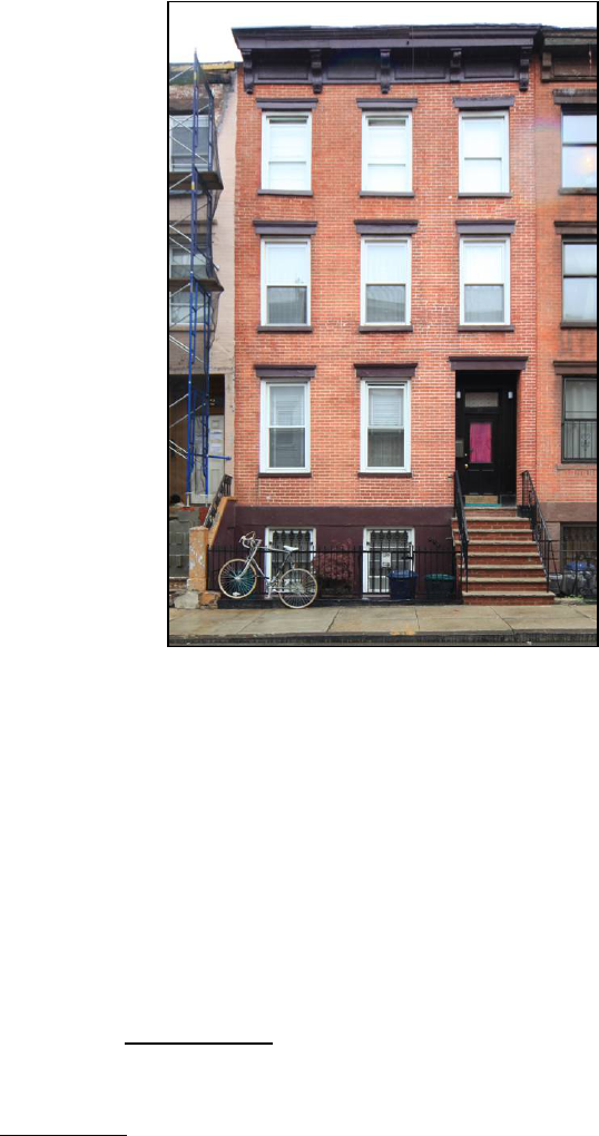
47
20 Fillmore Place
Borough of Brooklyn Tax Map Block 2382 Lot 9
Date of Construction: c. 1854
Builder: Jacob Sheppard
Original Owner: Clock and Miller
Type: Flats
Style: Italianate
Stories: Three and basement
Material: Brick with stone trim and wood cornice
Ownership History to 1950:
1846 Alfred Clock and Ephraim Miller
1883 Evelina A. Meserole
1905 Charles L. Wagner
1948 John and Olga G. Di Emanuele
History: This property was designated lot 29 on Clock
and Miller’s “Map of 37 Lots” and was originally
known as 11 Fillmore Place. It appears that the
building was erected in the mid 1850s by Jacob
Sheppard, a mason who had been commissioned by
Clock and Miller to erect most of the houses along the southern side of Fillmore Place. Clock
and Miller apparently rented out the building as an income-producing investment for several
decades. The property was eventually conveyed to Alfred Clock’s daughter, Evelina A.
Meserole, who retained ownership for over two decades into the early twentieth century.
Description: Three-bay, three-story Italianate-style brick flats building with raised basement;
stoop leads to entrance at right; recessed entrance enframement has molded stone hood and brick
reveal; wood door frame with paneled reveal, pilasters, single-pane transom light, and paneled
single-leaf door with rectangular light; rectangular window openings with molded stone lintels
and projecting stone sills; basement separated from ground floor by stuccoed stone belt course;
basement level has simple rectangular window openings with historic iron security grilles;
bracketed wood cornice with molded frieze panels. Site Features:
Non-historic metal fence and
gate with stuccoed stone edging enclosing sunken areaway; areaway has concrete paving with
stairs at right leading to basement entrance under stoop; non-historic metal security gate under
stoop; metal hatch in front of left bay. Alterations:
Stoop rebuilt with brick, railing replaced;
historic cast-iron areaway fence replaced; brickwork below ground floor windows rebuilt;
basement level stuccoed; all historic windows replaced; mailbox installed on left face of door
frame; lights installed on face of door frame on both sides of transom light.
References:
Kings County, Office of the Register, Liber Deeds and Conveyances.
New York City, Record of Tax Assessments, Brooklyn Ward 14, 1868-1898.
New York City, Division of Taxation, Tax Photographs, c. 1940.
United States Federal Census Records, 1860, 1870, 1880.
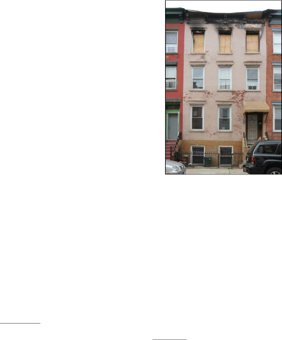
48
22 Fillmore Place
Borough of Brooklyn Tax Map Block 2382 Lot 10
Date of Construction: c. 1854
Builder: Jacob Sheppard
Original Owner: Clock and Miller
Type: Flats
Style: Italianate
Stories: Three and basement
Material: Brick with stone trim and wood cornice
Ownership History to 1950:
1846 Alfred Clock and Ephraim Miller
1868 Hugh W. Clifford
1891 Samuel Ramsey
1904 William J. Dailey
1930 Katarzyna and Peter Smykowski
1931 Jacob and Elizabeth Naurekvicius
History: This property was designated lot 28 on Clock
and Miller’s “Map of 37 Lots” and was originally
known as 9 Fillmore Place. It appears that the building
was erected in the mid 1850s by Jacob Sheppard, a mason who had been commissioned by Clock
and Miller to erect most of the houses along the southern side of Fillmore Place. Clock and
Miller apparently rented out the building as an income-producing investment for several years
before selling it in 1868 to Hugh W. Clifford. It appears that Clifford, a resident of Staten Island,
never resided in the building himself. It was sold to Samuel Ramsey at a foreclosure auction in
1891 following Clifford’s death. It was later acquired in 1904 by William J. Dailey, a prominent
resident of Fillmore Place who had resided at no. 18 since 1877; he had also purchased no. 16 in
1899.
Description: Three-bay, three story Italianate-style brick flats building with raised basement;
stoop with wrought-iron railing, cast-iron newels partially encased in stucco, and fully stuccoed
newel posts leads to entrance at right; recessed entrance enframement has brick reveal; historic
wood door frame with paneled reveal, pilasters, and single-pane transom light; rectangular
window openings with molded stone lintels and projecting stone sills; basement separated from
ground floor by stuccoed stone belt course; basement level has simple rectangular window
openings with historic iron security grilles; bracketed wood cornice with molded frieze panels.
Site Features:
Non-historic metal fence and gate with stuccoed stone edging enclosing sunken
areaway; areaway has concrete paving with stairs at right leading to basement entrance under
stoop; non-historic metal security gate under stoop. Alterations:
Stoop partially rebuilt, cast-iron
newels partially encased in stucco, cast-iron newel posts fully encased in stucco; historic cast-
iron areaway fence replaced; basement level stuccoed; molded stone hood over entrance
removed, fixed metal awning installed in its place; brickwork below ground floor windows
rebuilt; entrance door replaced; all historic windows replaced; façade painted; lights with

49
exposed conduit installed on face of door frame on both sides of transom light; one mailbox
installed on left door frame reveal, two mailboxes installed on right face of door frame; doorbells
installed on left face of door frame; cornice and third story show fire damage at time of
designation.
References:
Kings County, Office of the Register, Liber Deeds and Conveyances.
New York City, Record of Tax Assessments, Brooklyn Ward 14, 1868-1898.
New York City, Division of Taxation, Tax Photographs, c. 1940.
United States Federal Census Records, 1860, 1870, 1880.
24 Fillmore Place
Borough of Brooklyn Tax Map Block 2382 Lots 11
Date of Construction: c. 1855
Builder: John Rourke
Original Owner: John Rourke
Type: Flats
Style: Italianate
Stories: Three and basement
Material: Brick with stone trim and wood cornice
Ownership History to 1950:
1846 Alfred Clock and Ephraim Miller
1855 John Rourke
1857 Jeremiah V. Meserole
1857 Hugh Carrick
1863 Daniel Doneran
1863 Cornelius L. Johnson
1868 William Campbell
1874 John Keresey
1891 Harris and Abraham Blum
1915 Stanley Masiulis
1920 Anoton and Anna Raudzus
1921 Charles and Victoria Zdanowicz
1939 Anthony and Mary Danowitz
History: This property was designated lot 27 on Clock and Miller’s “Map of 37 Lots” and was
originally known as 7 Fillmore Place. It appears that the building was erected in the mid 1850s
by John Rourke, a mason who was closely affiliated with Jacob Sheppard, the primary builder of
houses along the southern side of Fillmore Place (census records from 1860 indicate that Rourke
and Sheppard occupied apartments in the same building; they also later jointly owned 30
Fillmore Place in the 1860s). Rourke sold the property to Alfred Clock’s son-in-law Jeremiah V.
Mesorle in 1857. The building subsequently had a series of owners during the late 1850s and
1860s. John Keresey, a glass maker, acquired the property in 1874 and resided in one of the

50
building’s apartments for nearly two decades. Harris and Abraham Blum purchased it in 1891
and retained ownership into the twentieth century.
Description: Three-bay, three-story Italianate-style brick flats building with raised basement;
stoop with wrought-iron railing and cast-iron newels partially encased in stucco leads to entrance
at right; recessed entrance enframement has stone lintel and brick reveal; rectangular window
openings with stone lintels and projecting stone sills; basement separated from ground floor by
stuccoed stone belt course; basement level has simple rectangular window openings with historic
iron security grilles; bracketed wood cornice with molded frieze panels. Site Features:
Non-
historic metal fence and gate with stuccoed stone edging encloses slightly sunken areaway;
areaway has stuccoed paving with stairs at right leading to basement entrance under stoop; non-
historic wood door under stoop; non-historic metal hand rail along stairs to basement entrance;
hatch in front of left bay. Alterations:
Stoop partially rebuilt, cast-iron newels partially encased
in stucco; historic cast-iron areaway fence replaced; basement level stuccoed; fixed metal awning
installed over basement entrance; historic door frame and door replaced, storm door added;
molded stone window lintels and door hood shaved down; brickwork below ground floor
windows rebuilt; all historic windows replaced; façade painted; light installed on both left and
right brick entrance enframement reveal; mailboxes installed on left door frame reveal; exposed
conduit attached along left side of building façade and under left window on third floor.
References:
Kings County, Office of the Register, Liber Deeds and Conveyances.
New York City, Record of Tax Assessments, Brooklyn Ward 14, 1868-1898.
New York City, Division of Taxation, Tax Photographs, c. 1940.
United States Federal Census Records, 1860, 1870, 1880.
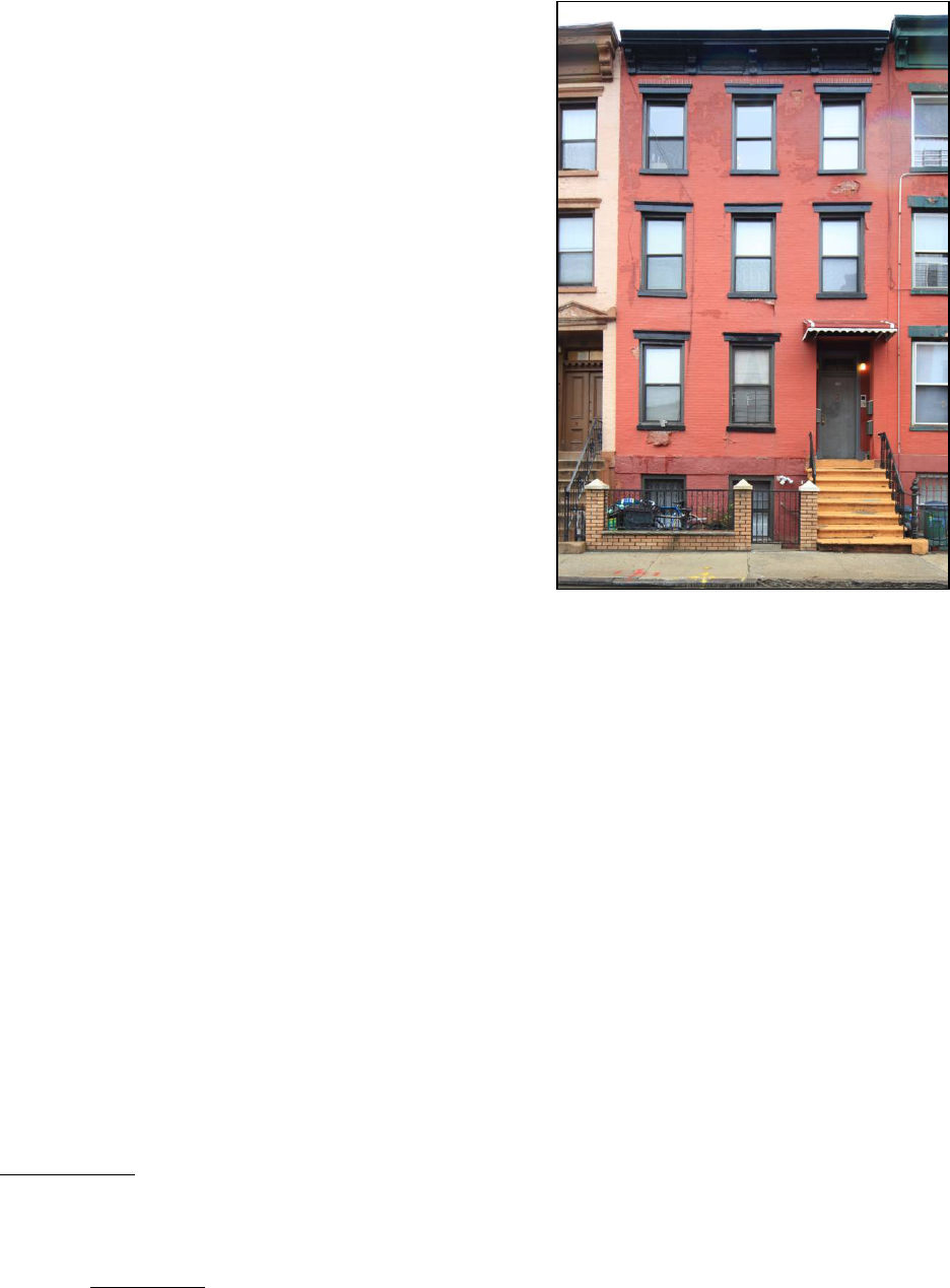
51
26 Fillmore Place
Borough of Brooklyn Tax Map Block 2382 Lots 12
Date of Construction: c. 1854
Builder: Jacob Sheppard
Original Owner: Clock and Miller
Type: Flats
Style: Italianate
Stories: Three and basement
Material: Brick with stone trim and wood cornice
Ownership History to 1950:
1846 Alfred Clock and Ephraim Miller
1854 Rebecca Sheppard
1856 William Parratt (aka Barratt) and Robert Miller
1857 Solomon Thomas
1868 Mary Thomas
1904 Herman A. Wagner
1919 Harold F. Wagner
1920 Tony and Verona Genvich
History: This property was designated lot 26 on Clock
and Miller’s “Map of 37 Lots” and was originally known as 5 Fillmore Place. It appears that the
building was erected in the mid 1850s by Jacob Sheppard, a mason who had been commissioned
by Clock and Miller to erect most of the houses along the southern side of Fillmore Place. The
building was sold in 1854 to Rebecca Sheppard, Jacob’s wife—possibly as part of the builder’s
compensation. The property was soon acquired in 1857 by Solomon Thomas, who is listed in
census records and directories as a shipmaster, pilot, and tug boat operator. Thomas’s family
occupied an apartment in this building for several decades into the early twentieth century; the
rest of the space was apparently rented out to other households—early tenants according to the
1860 United States Census included Thomas Flood, painter, and John Bennet, mason. The heirs
of Mary Thomas, Solomon’s wife, sold the property to Herman A. Wagner in 1904. Wagner
already owned 30 Fillmore Place and would eventually acquire 28 Fillmore Place as well.
Description: Three-bay, three-story Italianate-style brick flats building with raised basement;
stoop with wrought-iron railing, cast-iron newels, and right cast-iron newel post leads to entrance
at right; recessed entrance enframement has molded stone hood and brick reveal; wood door
frame with paneled reveal, pilasters, and double-paned transom light; rectangular window
openings with molded stone lintels and projecting stone sills; basement separated from ground
floor by stuccoed stone belt course; basement has simple rectangular window openings, left
opening retains historic iron security grille; bracketed wood cornice with molded frieze panels.
Site Features: Non-historic metal fence and gate with brick posts and edging enclosing slightly
sunken areaway; areaway has concrete paving with stairs at right leading to basement entrance
under stoop; historic iron security gate under stoop; non-historic metal hand rail along stairs to
basement entrance; hatch in front of left bay; stand pipes located between windows and to left of
left bay. Alterations:
Stoop resurfaced, part of left historic wrought- and cast-iron stoop railing

52
removed; historic cast-iron areaway fence replaced; fixed metal awning installed over entrance;
entrance door replaced; brickwork under ground floor windows rebuilt; metal flashing affixed to
top of cornice; all historic windows replaced; façade painted; one mailbox installed on left and
two mailboxes on right brick entrance enframement reveal; lights installed on face of door frame
on both sides of transom light; intercom installed in right face of door frame; light installed on
building façade above basement stairs.
References:
Kings County, Office of the Register, Liber Deeds and Conveyances.
New York City, Record of Tax Assessments, Brooklyn Ward 14, 1868-1898.
New York City, Division of Taxation, Tax Photographs, c. 1940.
United States Federal Census Records, 1860, 1870, 1880.
28 Fillmore Place
Borough of Brooklyn Tax Map Block 2382 Lot 13
Date of Construction: c. 1854
Builder: Jacob Sheppard
Original Owner: Clock and Miller
Type: Flats
Style: Italianate
Stories: Three and basement
Material: Brick with stone trim and wood cornice
Ownership History to 1950:
1846 Alfred Clock and Ephraim Miller
1860 Rebecca Sheppard
1862 Isaac Rushmore
1864 Charles and Mary Dougherty
1881 Andrew Mander
1919 Herman A. Wagner
1922 Matilda M. Wagner
1923 Frank and Anna Navakowsky
History: This property was designated lot 25 on Clock
and Miller’s “Map of 37 Lots” and was originally known as 3 Fillmore Place. It appears that the
building was erected in the mid 1850s by Jacob Sheppard, a mason who had been commissioned
by Clock and Miller to erect most of the houses along the southern side of Fillmore Place. In
1860 the building was acquired by Rebecca Sheppard, Jacob’s wife—possibly as part of the
builder’s compensation. The Sheppards lost the property in 1862 during a foreclosure suit.
Shortly thereafter the building was acquired by Charles and Mary Dougherty, whose family
resided in an apartment in the building for nearly two decades. Other early tenants according to
the 1870 United States census included David Douglass, printer, and Garry Springer, cooper. In
1881 Andrew Mander acquired the property and retained ownership for nearly forty years.
Herman A. Wagner, who already owned the adjacent buildings at 26 and 30 Fillmore Place,
acquired the property in 1919.

53
Description: Three-bay, three-story Italianate-style brick flats building with raised basement;
stoop leads to entrance at right; recessed entrance enframement has pedimented stone hood and
brick reveal; wood door frame with paneled reveal, dentiled transom bar, double-paned transom
light, and paneled double-leaf doors; rectangular window openings with molded stone lintels and
projecting stone sills; basement separated from ground floor by stone belt course; basement level
has simple rectangular window openings; bracketed wood cornice with molded frieze panels.
Site Features: Non-historic metal and gate fence enclosing grade-level areaway; areaway has
concrete paving with stairs at right leading to basement entrance under stoop; historic iron
security gate under stoop; hatch in front of left bay; stand pipe located at left of areaway.
Alterations: Stoop resurfaced, railing replaced; historic cast-iron areaway fence replaced;
brickwork below ground floor windows rebuilt; metal security grilles on basement window
openings replaced; all historic windows replaced; façade painted; gutter attached to left side of
façade; two mailboxes installed on left door frame reveal; doorbells installed on right face of
door frame; lights installed on face of door frame on both sides of transom light; mailbox and
doorbell installed on building façade above basement stairs; bracket for planter box installed
under left first floor window; exposed conduit attached to left façade up to second floor.
References:
Kings County, Office of the Register, Liber Deeds and Conveyances.
New York City, Record of Tax Assessments, Brooklyn Ward 14, 1868-1898.
New York City, Division of Taxation, Tax Photographs, c. 1940.
United States Federal Census Records, 1860, 1870, 1880.

54
30 Fillmore Place
Borough of Brooklyn Tax Map Block 2382 Lot 14
Date of Construction: 1870
Builders: Jacob Sheppard and John Rourke
Original Owner: Jacob Sheppard and John Rourke
Type: Flats
Style: Italianate
Stories: Three
Material: Brick with stone trim and wood cornice
Ownership History to 1950:
1867 Jacob Sheppard and John Rourke
1870 Theodore F. Jackson
1872 Esther and Jacob Sheppard
1874 Terrance McQuaid
1888 Herman A. Wagner
1919 Henry Wagner
History: This property was designated lot 24 on Clock
and Miller’s “Map of 37 Lots.” Clock and Miller sold
the unimproved lot—along with its neighbor at 168
Roebling Street—in 1852 to William R. and Mary Gibson. Within months the Gibsons sold both
properties to Cornelia and Robert H. Gibson. The lots exchanged hands several times during the
early 1850s until they were acquired in 1856 by Isaac Henderson, who subsequently sold the
individual parcel at 30 Fillmore Place Street to Jacob Sheppard and John Rourke. It appears that
Sheppard and Rourke—who were responsible for the construction of most of the buildings along
the southern side of Fillmore Place—erected this building in 1870. It was subsequently taken
over in foreclosure by Theodore F. Jackson, a major Brooklyn real estate investor. The property
was later acquired by Terrance McQuaid in 1874. It does not appear that McQuaid ever occupied
an apartment in the building. Early tenants according to the 1880 United States census included
Malcom Ritchey, ship carpenter, William Mills, house painter (the Mills eventually purchased
and occupied an apartment in 19 Fillmore Place across the street in 1888), and James Bebee, who
worked at a cooperage. McQuaid sold the building in 1888 to Herman A. Wagner, who would
eventually purchase the adjacent properties at 28 and 26 Fillmore Place. The building remained
in the Wagner family for several decades into the twentieth century.
Description: Three-story Italianate-style brick flats building. Main (North) Façade: Three bays
wide; entrance at right; entrance enframement has molded stone hood; wood door frame with
paneled reveal and double-paned transom light; rectangular window openings with molded stone
lintels and projecting stone sills; bracketed wood cornice with molded frieze panels. Side (East)
Façade: Plain brick wall. Site Features: Non-historic metal fence and gate enclosing slightly
raised areaway; areaway has concrete paving; metal hatch in front of left bay; stand pipes located
between windows. Alterations:
Historic cast-iron areaway fence replaced; sections of the cornice
have been patched with sheet metal; entrance door replaced; all historic windows replaced; light
installed on building façade to left of entrance.
55
References:
Kings County, Office of the Register, Liber Deeds and Conveyances.
New York City, Record of Tax Assessments, Brooklyn Ward 14, 1868-1898.
New York City, Division of Taxation, Tax Photographs, c. 1940.
United States Federal Census Records, 1860, 1870, 1880.
32 Fillmore Place
See: 168 Roebling Street
NORTH 1
ST
STREET, NO. 187 (NORTH SIDE, BETWEEN BEDFORD AVENUE AND
DRIGGS AVENUE)
187 North 1
st
Street
See: 676 Driggs Avenue
56
ROEBLING STREET, NO. 168 (WEST SIDE, BETWEEN GRAND STREET AND
FILLMORE PLACE)
168 Roebling Street (aka 32 Fillmore Place)
Borough of Brooklyn Tax Map Block 2382 Lot 15
Date of Construction: c. 1856
Builder: Not Determined
Original Owner: Not Determined
Type: Flats with store
Style: Italianate
Stories: Three
Material: Brick with stone trim and wood cornice
Ownership History to 1950:
1856 Isaac Henderson
1861 Henry Dahl and Charles Dahl
1870 John Tietjen
1936 Walter H. Von Bargen
1937 Herbert J.H. Von Bargen
History: This property was designated lot 20 on Clock
and Miller’s “Map of 37 Lots.” Clock and Miller sold
the property—along with its neighbor at 30 Fillmore
Place—in 1852 to William R. and Mary Gibson.
Within months the Gibsons sold both lots to Cornelia and Robert H. Gibson. The properties
exchanged hands several times during the early 1850s until they were acquired in 1856 by Isaac
Henderson, who subsequently sold off the parcel at 168 Roebling Street to Henry and Charles
Dahl in 1861. It is unclear exactly when the three-story brick flat was erected, but it was standing
by 1860 when census records indicate that the Dahls had already taken occupancy of an
apartment in the building. Other early tenants included Nicholas Dascher, clerk, and Thomas
Farley, clockmaker. Directories and census records indicate the Dahls were grocers operating out
of ground floor of this building. Another grocer, John Tietjen, purchased the property in 1870.
Tietjen eventually married Lena Lumpe and moved into her family’s residence at 16 Fillmore
Place, but it appears that he maintained his business in this building for several decades.
Roebling Street was widened around 1913, at which time this structure appears to have been
moved 20 feel to the west—eliminating the rear yard and one-story building that once stood at 32
Fillmore Place.
Description: Three-story Italianate-style brick flats building with ground floor storefront. Main
(East) Façade: Two bays wide; altered storefront at ground floor; one historic cast-iron pilaster
remains at building corner; ground floor separated from upper floors by corbelled brick belt
course; upper floors have segmental-arched window openings with segmental-arched molded
stone lintels and projecting stone sills; stone street sign at building corner between second and
third stories reads “SIXTH ST,” metal sign affixed just below reads “ROEBLING ST”;
bracketed wood cornice with molded frieze panels. Side (North) Façade: Four bays along

57
Fillmore Place; storefront wraps around part of side façade; entrances below third and fourth
bays towards right of façade; left entrance is plain rectangular opening, right entrance has
segmental-arched molded stone hood; upper floors have segmental-arched window openings
with segmental-arched molded stone lintels and projecting stone sills; stone street sign at
building corner between second and third stories reads “FILLMORE PLACE,” metal sign
affixed just below reads the same; bracketed wood cornice with molded frieze panels; stair
bulkhead visible above cornice. Side (South) Façade: Parged brick wall punctured irregularly
with rectangular window openings. Rear (West) Façade: Parged brick wall with pairs of
rectangular window openings in upper floors; metal gutter pipe attached to building corner.
Alterations: Ground floor storefront along Roebling Street and part of Fillmore Place completely
altered, now consists of brick infill with entrance at center—with simple metal door frame, metal
door, and roll down security gate—flanked by a pair of small rectangular window openings with
metal security grilles; cornice above storefront removed; left entrance in Fillmore Place façade
has been altered with segmental-arched molded lintel removed and entrance partially rebuilt to
make opening rectangular; right entrance in Fillmore Place façade has been altered with some
brick infill recessed inside opening to make openings shorter and rectangular; segmental-arched
lintels removed from center two window openings on second story of Fillmore Place façade;
right bay of window openings in Fillmore Place façade have been altered with brick infill,
openings now much smaller; signage installed above main entrance on Roebling Street façade;
cornice brackets partially encased in sheet metal; all historic windows replaced; façade painted;
light installed in building façade above main entrance on Roebling Street; lights installed on
building façade on both sides of right entrance on Fillmore Place elevation, mailbox installed to
left and intercom to right of same entrance.
References:
Kings County, Office of the Register, Liber Deeds and Conveyances.
New York City, Record of Tax Assessments, Brooklyn Ward 14, 1868-1898.
New York City, Division of Taxation, Tax Photographs, c. 1940.
United States Federal Census Records, 1860, 1870, 1880.
